The Pronk Pops Show 1447, December 13, 2021 — Video –Story 1: American People’s Chief Concerns: Inflation, The Economy, Crime, Massive Illegal Alien Invasion of the United States Due to Democrat/Biden’s Open Border’s Policy — Videos — Story 2: Confusing Weather Events with Climate Change — Man Can Change Neither — Adapt — Videos

The Pronk Pops Show Podcasts
The Pronk Pops Show 1447 December 13, 2021 posted as soon as available
The Pronk Pops Show 1446 December 7, 2021, 2021
The Pronk Pops Show 1445 December 6, 2021, 2021
The Pronk Pops Show 1444 November 30, 2021
The Pronk Pops Show 1443 November 29, 2021
The Pronk Pops Show 1442 November 19, 2021
The Pronk Pops Show 1441 November 18, 2021
The Pronk Pops Show 1440 November 15, 2021
The Pronk Pops Show 1439 November 12, 2021
The Pronk Pops Show 1438 November 5, 2021
The Pronk Pops Show 1437 November 2, 2021
The Pronk Pops Show 1436 October 29, 2021
The Pronk Pops Show 1435 October 28, 2021
The Pronk Pops Show 1434 October 21, 2021
The Pronk Pops Show 1433 October 15, 2021
The Pronk Pops Show 1432 October 14, 2021
The Pronk Pops Show 1431 October 13, 2021
The Pronk Pops Show 1430 October 07, 2021
The Pronk Pops Show 1429 October 05, 2021
The Pronk Pops Show 1428 October 04, 2021
The Pronk Pops Show 1427 September 29, 2021
The Pronk Pops Show 1426 September 28, 2021
The Pronk Pops Show 1425 September 24, 2021
The Pronk Pops Show 1424 September 23, 2021
The Pronk Pops Show 1423 September 21, 2021
The Pronk Pops Show 1422 September 17, 2021
The Pronk Pops Show 1421 September 16, 2021
The Pronk Pops Show 1420 September 15, 2021
The Pronk Pops Show 1419 September 13, 2021
The Pronk Pops Show 1418 September 10, 2021
The Pronk Pops Show 1417 August 26, 2021
The Pronk Pops Show 1416 August 25, 2021
The Pronk Pops Show 1415 August 24, 2021
The Pronk Pops Show 1414 August 23, 2021
COVID-19 Closed KDUX Studios From March 14, 2020 Through August 22, 2021
The Pronk Pops Show 1413 March 13, 2020 cancelled due to COVID -19
The Pronk Pops Show 1412 March 12, 2020
The Pronk Pops Show 1410 March 10, 2020
The Pronk Pops Show 1409 March 9, 2020
The Pronk Pops Show 1408 March 6, 2020
The Pronk Pops Show 1409 March 5, 2020
The Pronk Pops Show 1408 March 6, 2020
The Pronk Pops Show 1407 March 5, 2020
The Pronk Pops Show 1406 March 4, 2020
Story 1: American People’s Chief Concerns: Inflation, The Economy, Crime, Massive Illegal Alien Invasion of the United States Due to Democrat/Biden’s Open Border’s Policy — Videos —


US inflation rate rose 6.8% in 2021, the highest increase since 1982
Biden re-election poll shows dismal 22% support; Harris even worse at 12%
")
By JOE DWINELL | joed@bostonherald.com | Boston HeraldPUBLISHED: December 7, 2021 at 6:16 p.m. | UPDATED: December 7, 2021 at 10:11 p.m.
The numbers are cringeworthy — 22% and 12%.
That’s the support for President Biden and his VP Kamala Harris in an I&I/TIPP poll that asked who would you vote for in the 2024 election. Even if you doubt the veracity of all this polling, these are poor numbers.
The only good news for Biden, the survey adds, is “no favorite has emerged among the large field of potential challengers to run against Biden in the 2024 primaries.”
But the sinking survey results are not out of the norm. A Wall Street Journal poll out Tuesday pegged Biden’s approval rating at a dismal 41%. Rasmussen had it at 42%.https://imasdk.googleapis.com/js/core/bridge3.491.0_en.html#goog_1087091901Read More
Congress, however, was at 22% in the Journal poll, but that’s another story.
“It’s undeniable. Joe Biden is hurting in the polls right now and it’s due to a number of factors,” said Erin O’Brien, associate professor of political science at UMass Boston.
Those factors, she said, include the nagging pandemic, soaring inflation, lingering doubts about Biden’s foreign policy chops after the botched pullout from Kabul and lingering legislation.
The Journal adds that with Biden flatlining in the polls, he won’t be in a position to help Democrats fighting to keep their jobs in the midterms.
This comes as Democrats hold a slim majority in the House, where the split is 221-213, and in the Senate, at 50-50, but with Harris as the tiebreaker.
Support for former President Donald Trump remains strong among those loyal to him, so that also could be reflected in the polling that shows Biden needs to rebound or it will be too late to get much done in the second half of his tenure.
Now Biden faces a new challenge.
He held a video conference Tuesday with Russia’s Vladimir Putin over Russian troops heading toward the Ukrainian border.
Just hours before the call got underway, the Associated Press reported that Ukrainian officials charged Russia was continuing to escalate the crisis by sending tanks and snipers to war-torn eastern Ukraine to “provoke return fire.”
Republicans are watching to see how Biden fares, considering how poorly his administration handled withdrawal from Afghanistan.
It’s all showing in the polls, with the Journal adding 63% of voters said the country had gone off-track, with just 27% saying the nation was on the right course. Some 61% said the economy was headed in the wrong direction.
For six months in a row prices increased across many sectors, including gas, food and housing

Lauren ArataniFri 10 Dec 2021 09.06 EST
The US inflation rate rose 6.8% over the last year, the highest increase since 1982, the Bureau of Labor Statistics reported Friday morning.
Inflation rose 0.8% in November after rising 0.9% in October. Price increases were seen across many sectors, including gas, food and housing. This is the sixth month in a row the US is seeing price increases.
Gasoline prices rose by 58.1% in November – the largest increase over 12 months since 1980.
Within the food index, grocery store prices increased across the board for a third month in a row. Meat, poultry, fish and eggs saw a 0.9% increase in November while cereals and bakery products saw price increases of 0.8%.Advertisement
The price index that does not include food and energy rose 0.5% in November after a 0.6% increase in October. The prices of used and new cars, household furnishings, apparel and airline fares all notably rose last month.
Ahead of Friday’s data release, Joe Biden released a statement saying that the inflation rate “does not reflect today’s reality”.
“It does not reflect the expected price decreases in the weeks and months ahead, such as in the auto market,” Biden said in the statement.
As inflation has become a line of attack from the administration’s critics over the last few months, the White House has maintained that today’s inflation is “transitory”, or a temporary rise in prices, because of the pandemic.
The Federal Reserve last month took its first step to curb some of its pandemic assistance after pressure from critics around inflation. The central bank in November ended some of its stimulus programs, in which it bought bonds to stimulate the economy. But the Fed held off from adjusting interest rates – its main tool to control rising prices.
Rising prices tend to be a political sore spot for the party in power, though its causes are complex. Republicans are already blaming Biden for Friday’s number, with the Senate minority leader, Mitch McConnell, criticizing Democrats on Twitter for responding to inflation “by ramming through another massive socialist spending package”, referring to the $1.75tn social and climate spending bill that is in negotiations.https://platform.twitter.com/embed/Tweet.html?dnt=true&embedId=twitter-widget-0&features=eyJ0ZndfZXhwZXJpbWVudHNfY29va2llX2V4cGlyYXRpb24iOnsiYnVja2V0IjoxMjA5NjAwLCJ2ZXJzaW9uIjpudWxsfSwidGZ3X2hvcml6b25fdHdlZXRfZW1iZWRfOTU1NSI6eyJidWNrZXQiOiJodGUiLCJ2ZXJzaW9uIjpudWxsfSwidGZ3X3NwYWNlX2NhcmQiOnsiYnVja2V0Ijoib2ZmIiwidmVyc2lvbiI6bnVsbH19&frame=false&hideCard=false&hideThread=false&id=1469313833760169989&lang=en&origin=https%3A%2F%2Fwww.theguardian.com%2Fbusiness%2F2021%2Fdec%2F10%2Fus-inflation-rate-rise-2021-highest-increase-since-1982&sessionId=2d2d4c6953397cccebe13c8c95a6748a0d4a812f&siteScreenName=guardian&theme=light&widgetsVersion=9fd78d5%3A1638479056965&width=550px
While economists have been divided over the concern the federal government should have over inflation, some have pointed out that while inflation has been rising, the unemployment rate has remained low and wages have been increasing. And while consumer confidence has dropped because of inflation, spending has been strong with retail sales rising in October.$839,629contributions$1,250,000our goal
–
–
Limitations of the Consumer Price Index (CPI)?
By J.B. MAVERICK Updated August 01, 2021Reviewed by SOMER ANDERSONMacroeconomics
TABLE OF CONTENTS
- The CPI “Basket”
- Substitutable Goods
- Does Not Capture Innovation
- Weight on Urban Consumption
- The Bottom Line
A country’s consumer price index, or CPI, is considered one of the most fundamental and critically important economic indicators measuring inflation, not only in the United States but in virtually every other developed nation as well.1https://13788af8ee9c70bc0cfe34dae621b1ec.safeframe.googlesyndication.com/safeframe/1-0-38/html/container.html
The release of monthly CPI numbers almost invariably has a significant impact on the financial markets, and unexpectedly high or low numbers often wreak investment havoc. The U.S. Bureau of Labor Statistics (BLS) releases several different consumer price indexes on a monthly basis, including the CPI. But despite the CPI being followed so relentlessly, the index is far from perfect as a measure of either inflation or the cost of living, and it has a number of inherent weaknesses.https://13788af8ee9c70bc0cfe34dae621b1ec.safeframe.googlesyndication.com/safeframe/1-0-38/html/container.html
Although the CPI is widely used as the core indicator of inflation, its accuracy in this area has drawn increasing criticism. For example, during a period when energy costs rose by more than 50% and the prices of some of the most commonly purchased grocery items increased by nearly 30%, the CPI continued to show a very modest inflation rate. In contrast, other indicators measuring the buying power of consumers showed a dramatic increase in the cost of living. Here, we take a look at some of the limitations of using CPI and why this controversy persists.
KEY TAKEAWAYS
- The consumer price index, or CPI, is the most widely used measure of a country’s rate of inflation, but it has come under fire as being less than ideal.
- The CPI measure utilizes a basket of goods methodology, which has several flaws including which goods are included in that basket and the effect of substitution.
- CPI also only considers urban consumers and does not attend to consumer demographics, which can also lead to distortions created by these generalizations.
The CPI “Basket”
The CPI is a weighted index of goods purchased by consumers.2 While it may constitute a relatively good measure of price changes in the specific goods purchased in its “basket,” one limitation of the CPI is that the consumer goods it considers do not provide a sampling that represents all production or consumption in the economy. Therefore, as a basic economic barometer, the CPI is inherently flawed.https://13788af8ee9c70bc0cfe34dae621b1ec.safeframe.googlesyndication.com/safeframe/1-0-38/html/container.html
Currently, the basket of goods includes basic food and beverages such as cereal, milk, and coffee. It also includes housing costs, bedroom furniture, apparel, transportation expenses, medical care costs, recreational expenses, toys, and the cost of admissions to museums also qualify. Education and communication expenses are included in the basket’s contents, and the government also takes note of other, seemingly random items such as tobacco, haircuts, and funerals.https://13788af8ee9c70bc0cfe34dae621b1ec.safeframe.googlesyndication.com/safeframe/1-0-38/html/container.html
Still, the goods in the basket are only a sampling of the universe of goods and services available to consumers and, as a result, may experience some serious blind spots.
In June 2021, the Consumer Price Index increased 0.9% from May to June, faster than the 0.6% month-over-month increase from April. When compared to the year prior, the full index increased 5.4%, making it the largest 12-month increase since September 2008.3
Substitutable Goods
One problem with the CPI identified by economists, and which even the U.S. Bureau of Labor Statistics (which produces the CPI) freely admits, is that the index does not factor in the effects of substitution.4 The economic reality is that when certain goods become significantly more expensive, many consumers find less expensive alternatives to them. For instance, buying the store brand instead of the name brand, or buying regular gasoline instead of premium grade.
Unable to take this common practice into account, the CPI instead presents numbers that go on assuming consumers are continuing to buy the same amount of increasingly expensive goods.
Does Not Capture Innovation
Novelty and innovation represent another weakness in the CPI. Products do not become included in the CPI’s basket of goods until they become virtual staple purchases by consumers as seen over time. So even though new products may represent considerable consumer expenditures, they may still be years away from possible inclusion in the calculation of the CPI.5
Any pure price index is flawed by the fact it does not factor in changes in the quality of goods purchased. Consumers may gain a net benefit from purchasing a product that has risen in price as a result of significant improvements in the quality of the product and the purposes it serves. But the CPI has no standard for measuring such quality improvements and therefore reflects only the increase in price without any appreciation for additional advantages to consumers.
Too Much Weight on Urban Consumption
Because the CPI is purposely constructed with a focus on the buying habits of urban consumers, it has often been criticized as not providing an accurate measure of either the prices of goods or the consumer buying habits for more suburban or rural areas. While cities are indeed the most important centers of economic production, a large swath of a nation’s population still lives outside of metropolitan areas, where prices may be higher due to that distance from the center.
As a broader critique, the CPI also does not provide separate reports according to different demographic groups.6
The Bottom Line
Despite its drawbacks, the CPI is widely used: It provides the basis for annual cost of living adjustments to Social Security payments and other government-funded programs, for example.7
That probably won’t change soon, but it’s important to recognize be aware of its limitations.
Over the years, the basket methodology used to calculate the CPI has undergone several revisions. According to the BLS, the changes have looked to remove or reduce biases that caused the CPI to overstate the inflation rate. Still, as long as CPI is used to track inflation officially, controversy will remain.SPONSOREDFind the Right Financial Advisor For YouFinding the right financial advisor that fits your needs doesn’t have to be hard. SmartAsset’s free tool matches you with fiduciary financial advisors in your area in 5 minutes. Each advisor has been vetted by SmartAsset and is legally bound to act in your best interests. If you’re ready to be matched with local advisors that will help you achieve your financial goals, get started now.
ARTICLE SOURCES
Investopedia requires writers to use primary sources to support their work. These include white papers, government data, original reporting, and interviews with industry experts. We also reference original research from other reputable publishers where appropriate. You can learn more about the standards we follow in producing accurate, unbiased content in our editorial policy.
- U.S. Bureau of Labor Statistics. “Consumer Price Index.” Accessed April 22, 2020.
- U.S. Bureau of Labor Statistics. “Consumer Price Index Frequently Asked Questions – What goods and services does the CPI cover?” Accessed April 22, 2020.
- U.S. Bureau of Labor Statistics. “Consumer Price Index Summary.” Accessed July 13, 2021.
- U.S. Bureau of Labor Statistics. “Common Misconceptions about the Consumer Price Index: Questions and Answers.” Accessed April 22, 2020.
- U.S. Bureau of Labor Statistics. “Changing the item structure of the Consumer Price Index.” Accessed April 22, 2020.
- U.S. Bureau of Labor Statistics. “Consumer Price Index Frequently Asked Questions – What are some limitations of the CPI?” Accessed April 22, 2020.
- Social Security Administration. “Cost-of-Living Adjustment (COLA) Information for 2020.” Accessed April 22, 2020.
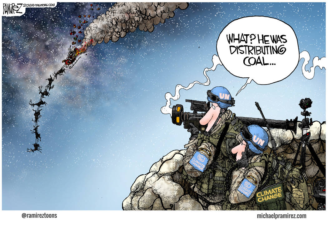
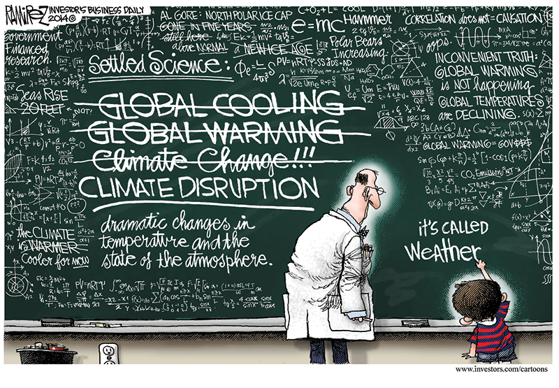
Story 2: Confusing Weather Events with Climate Change — Man Can Change Neither — Adapt — Videos


Fujita scale
From Wikipedia, the free encyclopediaJump to navigationJump to searchWe ask you, humbly: don’t scroll away. Hi reader. This is the 3rd time we’ve interrupted your reading recently, but 98% of our readers don’t give. Many think they’ll give later, but then forget. This Monday we ask you to protect Wikipedia. All we ask is $2.75, or what you can afford, to secure our future. We ask you, humbly: Please don’t scroll away. If you are one of our rare donors, we warmly thank you.Please select a payment method
MAYBE LATER CLOSE
| F0 | < 73 mph | Light damage |
|---|---|---|
| F1 | 73–112 mph | Moderate damage |
| F2 | 113–157 mph | Considerable damage |
| F3 | 158–206 mph | Severe damage |
| F4 | 207–260 mph | Devastating damage |
| F5 | 261–318 mph | Incredible damage |
“F2 tornado” and “F3 tornado” redirect here. For the F2 and F3 air defence variants of the Panavia Tornado military aircraft, see Panavia Tornado ADV.
The Fujita scale (F-Scale; /fuˈdʒiːtə/), or Fujita–Pearson scale (FPP scale), is a scale for rating tornado intensity, based primarily on the damage tornadoes inflict on human-built structures and vegetation. The official Fujita scale category is determined by meteorologists and engineers after a ground or aerial damage survey, or both; and depending on the circumstances, ground-swirl patterns (cycloidal marks), weather radar data, witness testimonies, media reports and damage imagery, as well as photogrammetry or videogrammetry if motion picture recording is available. The Fujita scale was replaced with the Enhanced Fujita scale (EF-Scale) in the United States in February 2007. In April 2013, Canada adopted the EF-Scale over the Fujita scale along with 31 “Specific Damage Indicators” used by Environment Canada (EC) in their ratings.[1][2]
Contents
- 1Background
- 2Derivation
- 3Parameters
- 4Rating classifications
- 5Decommissioning in the U.S.
- 6See also
- 7References
- 8External links
Background
The scale was introduced in 1971 by Ted Fujita of the University of Chicago, in collaboration with Allen Pearson, head of the National Severe Storms Forecast Center/NSSFC (currently the Storm Prediction Center/SPC). The scale was updated in 1973, taking into account path length and width. In the United States, starting in 1973, tornadoes were rated soon after occurrence. The Fujita scale was applied retroactively to tornadoes reported between 1950 and 1972 in the National Oceanic and Atmospheric Administration (NOAA) National Tornado Database. Fujita rated tornadoes from 1916 to 1992[3][4] and Tom Grazulis of The Tornado Project retroactively rated all known significant tornadoes (F2–F5 or causing a fatality) in the U.S. back to 1880.[5] The Fujita scale was adopted in most areas outside of Great Britain.[citation needed]
On February 1, 2007, the Fujita scale was decommissioned, and the Enhanced Fujita Scale was introduced in the United States.[6] The new scale more accurately matches wind speeds to the severity of damage caused by the tornado.
Though each damage level is associated with a wind speed, the Fujita scale is effectively a damage scale, and the wind speeds associated with the damage listed aren’t rigorously verified. The Enhanced Fujita Scale was formulated due to research that suggested that the wind speeds required to inflict damage by intense tornadoes on the Fujita scale are greatly overestimated. A process of expert elicitation with top engineers and meteorologists resulted in the EF scale wind speeds, but these are biased to United States construction practices. The EF scale also improved damage parameter descriptions.
Derivation

The original scale as derived by Fujita was a theoretical 13-level scale (F0–F12) designed to smoothly connect the Beaufort scale and the Mach number scale. F1 corresponds to the twelfth level of the Beaufort scale, and F12 corresponds to Mach number 1.0. F0 was placed at a position specifying no damage (approximately the eighth level of the Beaufort scale), in analogy to how Beaufort’s zeroth level specifies little to no wind. From these wind speed numbers, qualitative descriptions of damage were made for each category of the Fujita scale, and then these descriptions were used to classify tornadoes.[7] The diagram on the right illustrates the relationship between the Beaufort, Fujita, and Mach number scales.
At the time Fujita derived the scale, little information was available on damage caused by wind, so the original scale presented little more than educated guesses at wind speed ranges for specific tiers of damage. Fujita intended that only F0–F5 be used in practice, as this covered all possible levels of damage to frame homes as well as the expected estimated bounds of wind speeds. He did, however, add a description for F6, which he called an “inconceivable tornado”, to allow for wind speeds exceeding F5 and possible advancements in damage analysis that might show it.[8] Based on aerial photographs of the damage it caused, Fujita assigned the strongest tornado of the 1974 Super Outbreak, which affected Xenia, Ohio, a preliminary rating of F6 intensity ± 1 scale.[9]
Furthermore, the original wind speed numbers have since been found to be higher than the actual speeds required to incur the damage described at each category. The error manifests itself to an increasing degree as the category increases, especially in the range of F3 through F5. NOAA notes that “precise wind speed numbers are actually guesses and have never been scientifically verified. Different wind speeds may cause similar-looking damage from place to place—even from building to building. Without a thorough engineering analysis of tornado damage in any event, the actual wind speeds needed to cause that damage are unknown.”[8] Since then, the Enhanced Fujita Scale has been created using better wind estimates by engineers and meteorologists.
Parameters
The six categories are listed here, in order of increasing intensity.
- The rating of any given tornado is of the most severe damage to any well-built frame home or comparable level of damage from engineering analysis of other damage.
- Since the Fujita scale is based on the severity of damage resulting from high winds, a tornado exceeding F5 is an immeasurable theoretical construct. Frame-home structural damage cannot exceed total destruction and debris dispersal, which constitutes F5 damage. A tornado with wind speeds greater than 319 miles per hour (513 km/h) is theoretically possible, and the 1999 Bridge Creek-Moore Tornado may have been such an event, but no such wind speed has ever been recorded and that measurement was not near ground level.
| Scale | Wind speed estimate[6] | Frequency[10] | Potential damage[6] | ||
| mph | km/h | ||||
| F0 | 40–72 | 64–116 | 44.14% | Light damage.Small trees are blown down and bushes are uprooted. Shingles are ripped off roofs, windows in cars and buildings are blown out, medium to large branches snapped off of large trees, sheds are majorly damaged, and loose small items are tossed and blown away (i.e. lawn chairs, plastic tables, sports equipment, mattresses). Barns are damaged. | |
| F1 | 73–112 | 117–180 | 34.24% | Moderate damage.Roofs stripped from shingles or planting. Small areas of roof may be blown off house. Doors and garage doors blown in, siding ripped off houses, mobile homes flipped or rolled onto their sides, small trees uprooted, large trees snapped or blown down, telephone poles snapped, outhouses and sheds blown away. Cars occasionally flipped or blown over, and moderate roof and side damage to barns. Corn stalks slightly bent and stripped of leaves. | |
| F2 | 113–157 | 181–253 | 16.17% | Significant damage.Whole roofs ripped off frame houses, interiors of frame homes damaged, small and medium trees uprooted. | |
| F3 | 158–206 | 254–332 | 4.35% | Severe damage.Roofs and numerous outside walls blown away from frame homes, all trees in its path uprooted and/or lofted, two-story homes have their second floor destroyed, highrises have many windows blown out, radio towers blown down, metal buildings (i.e. factories, power plants, and construction sites) are heavily damaged, sometimes completely destroyed. Barns completely collapse, and large vehicles such as tractors, buses, and forklifts are blown from their original positions. | |
| F4 | 207–260 | 333–418 | 1.01% | Devastating damage.Trees partially debarked, cars are mangled and thrown in the air, frame homes are completely destroyed and some may be swept away, moving trains blown off railroad tracks, and barns are leveled. | |
| F5 | 261–318 | 419–512 | 0.10% | Incredible damage.Cars are mangled and thrown hundreds, possibly thousands of yards away. Frame homes, brick homes, small businesses, and barns are swept away, trees debarked, corn stalks flattened or ripped out of the ground, skyscrapers sustain major structural damage, grass ripped out of the ground. Wood and any small solid material become dangerous projectiles. |
Rating classifications
| F0 | F1 | F2 | F3 | F4 | F5 |
|---|---|---|---|---|---|
| Weak | Strong | Violent | |||
| Significant | |||||
| Intense |
For purposes such as tornado climatology studies, Fujita scale ratings may be grouped into classes.[5][11][12]
Decommissioning in the U.S.
Main article: Enhanced Fujita scale
The Fujita scale, introduced in 1971 as a means to differentiate tornado intensity and path area, assigned wind speeds to damage that were, at best, educated guesses.[13] Fujita and others recognized this immediately and intensive engineering analysis was conducted through the rest of the 1970s. This research, as well as subsequent research, showed that tornado wind speeds required to inflict the described damage were actually much lower than the F-scale indicated, particularly for the upper categories. Also, although the scale gave general descriptions of damage a tornado could cause, it gave little leeway for strength of construction and other factors that might cause a building to sustain more damage at lower wind speeds. Fujita tried to address these problems somewhat in 1992 with the Modified Fujita Scale,[14] but by then he was semi-retired and the National Weather Service was not in a position to update to an entirely new scale, so it went largely unenacted.[15]
In the United States, on February 1, 2007,[1] the Fujita scale was decommissioned in favor of what scientists believe is a more accurate Enhanced Fujita Scale. The meteorologists and engineers who designed the EF Scale believe it improves on the F-scale on many counts. It accounts for different degrees of damage that occur with different types of structures, both manmade and natural. The expanded and refined damage indicators and degrees of damage standardize what was somewhat ambiguous. It also is thought to provide much better estimates of wind speeds and sets no upper limit on the wind speeds for the highest level, EF5. Several countries[which?] still use the original Fujita Scale. Environment Canada began using the Enhanced Fujita scale in Canada on April 1, 2013.[16]
See also
- Enhanced Fujita Scale
- Lists of tornadoes and tornado outbreaks
- Rohn Emergency Scale for measuring the magnitude (intensity) of any emergency
- Saffir–Simpson Hurricane Scale
- Severe weather terminology (United States)
- Tornado intensity and damage
- Tornado records
- TORRO scale
- Wind engineering
References
- ^ Jump up to:a b “Fujita Tornado Damage Scale”. spc.noaa.gov. Retrieved May 27, 2017.
- ^ “Fujita Scale – Tornado Damage Scale”. factsjustforkids.com. Retrieved June 14, 2019.
- ^ McDonald, James R. (2001). “American Meteorological Society”. Bulletin of the American Meteorological Society. 82: 63–72. Bibcode:2001BAMS…82…63M. doi:10.1175/1520-0477(2001)000<0063:TTFHCT>2.3.CO;2.
- ^ McCarthy, Daniel. “NWS TORNADO SURVEYS AND THE IMPACT ON THE NATIONAL TORNADO” (PDF). http://www.spc.noaa.gov.
- ^ Jump up to:a b Grazulis, Thomas P. (July 1993). Significant Tornadoes 1680–1991. St. Johnsbury, Vermont: The Tornado Project of Environmental Films. ISBN 978-1-879362-03-1.
- ^ Jump up to:a b c Fujita Tornado Damage Scale Storm Prediction Center. Accessed May 20, 2009.
- ^ “Storm Prediction Center”. spc.noaa.gov. Retrieved May 27,2017.
- ^ Jump up to:a b Tornado FAQ. Storm Prediction Center. Site accessed June 27, 2006.
- ^ Fujita, T. Theodore (1974). “Jumbo Tornado Outbreak of 3 April 1974” (PDF).
- ^ “Storm Prediction Center WCM Data”. Storm Prediction Center. Retrieved September 15, 2021.
- ^ The Fujita Scale of Tornado Intensity, Archived at: ArchivedDecember 30, 2011, at the Wayback Machine
- ^ Brooks, Harold. “index”. nssl.noaa.gov. Archived from the original on October 4, 2012. Retrieved May 27, 2017.
- ^ Fujita, Tetsuya Theodore (1971). Proposed characterization of tornadoes and hurricanes by area and intensity. Chicago: University of Chicago.
- ^ Center, Storm Prediction. “NOAA’s NWS Storm Prediction Center”. http://www.spc.noaa.gov. Retrieved May 27, 2017.
- ^ Fujita, Tetsuya Theodore (1992). Memoirs of an Effort to Unlock the Mystery of Severe Storms. Chicago: University of Chicago.
- ^ Assessing tornado damage: EF-scale vs. F-scale ArchivedApril 27, 2013, at the Wayback Machine
Bibliography
- Marshall, Timothy P. (2001). “Birth of the Fujita Scale”. Storm Track. 24 (3): 6–10.
- Edwards, Roger; J. G. LaDue; J. T. Ferree; K. Scharfenberg; C. Maier; W. L. Coulbourne (2013). “Tornado Intensity Estimation: Past, Present, and Future”. Bull. Amer. Meteor. Soc. 94 (5): 641–53. Bibcode:2013BAMS…94..641E. doi:10.1175/BAMS-D-11-00006.1.
External links
- Enhanced F Scale for Tornado Damage (SPC)
- The Enhanced Fujita Scale (EF Scale) (SPC)
- A Guide for Conducting Convective Windstorm Surveys (NWS SR146)
- The Tornado: An Engineering-Oriented Perspective (NWS SR147)
- Fujita archival records (Texas Tech University)
Fujita scale
From Wikipedia, the free encyclopediaJump to navigationJump to searchWe ask you, humbly: don’t scroll away. Hi reader. This is the 3rd time we’ve interrupted your reading recently, but 98% of our readers don’t give. Many think they’ll give later, but then forget. This Monday we ask you to protect Wikipedia. All we ask is $2.75, or what you can afford, to secure our future. We ask you, humbly: Please don’t scroll away. If you are one of our rare donors, we warmly thank you.Please select a payment method
MAYBE LATER CLOSE
| F0 | < 73 mph | Light damage |
|---|---|---|
| F1 | 73–112 mph | Moderate damage |
| F2 | 113–157 mph | Considerable damage |
| F3 | 158–206 mph | Severe damage |
| F4 | 207–260 mph | Devastating damage |
| F5 | 261–318 mph | Incredible damage |
“F2 tornado” and “F3 tornado” redirect here. For the F2 and F3 air defence variants of the Panavia Tornado military aircraft, see Panavia Tornado ADV.
The Fujita scale (F-Scale; /fuˈdʒiːtə/), or Fujita–Pearson scale (FPP scale), is a scale for rating tornado intensity, based primarily on the damage tornadoes inflict on human-built structures and vegetation. The official Fujita scale category is determined by meteorologists and engineers after a ground or aerial damage survey, or both; and depending on the circumstances, ground-swirl patterns (cycloidal marks), weather radar data, witness testimonies, media reports and damage imagery, as well as photogrammetry or videogrammetry if motion picture recording is available. The Fujita scale was replaced with the Enhanced Fujita scale (EF-Scale) in the United States in February 2007. In April 2013, Canada adopted the EF-Scale over the Fujita scale along with 31 “Specific Damage Indicators” used by Environment Canada (EC) in their ratings.[1][2]
Contents
- 1Background
- 2Derivation
- 3Parameters
- 4Rating classifications
- 5Decommissioning in the U.S.
- 6See also
- 7References
- 8External links
Background[edit]
The scale was introduced in 1971 by Ted Fujita of the University of Chicago, in collaboration with Allen Pearson, head of the National Severe Storms Forecast Center/NSSFC (currently the Storm Prediction Center/SPC). The scale was updated in 1973, taking into account path length and width. In the United States, starting in 1973, tornadoes were rated soon after occurrence. The Fujita scale was applied retroactively to tornadoes reported between 1950 and 1972 in the National Oceanic and Atmospheric Administration (NOAA) National Tornado Database. Fujita rated tornadoes from 1916 to 1992[3][4] and Tom Grazulis of The Tornado Project retroactively rated all known significant tornadoes (F2–F5 or causing a fatality) in the U.S. back to 1880.[5] The Fujita scale was adopted in most areas outside of Great Britain.[citation needed]
On February 1, 2007, the Fujita scale was decommissioned, and the Enhanced Fujita Scale was introduced in the United States.[6] The new scale more accurately matches wind speeds to the severity of damage caused by the tornado.
Though each damage level is associated with a wind speed, the Fujita scale is effectively a damage scale, and the wind speeds associated with the damage listed aren’t rigorously verified. The Enhanced Fujita Scale was formulated due to research that suggested that the wind speeds required to inflict damage by intense tornadoes on the Fujita scale are greatly overestimated. A process of expert elicitation with top engineers and meteorologists resulted in the EF scale wind speeds, but these are biased to United States construction practices. The EF scale also improved damage parameter descriptions.
Derivation[edit]
The original scale as derived by Fujita was a theoretical 13-level scale (F0–F12) designed to smoothly connect the Beaufort scale and the Mach number scale. F1 corresponds to the twelfth level of the Beaufort scale, and F12 corresponds to Mach number 1.0. F0 was placed at a position specifying no damage (approximately the eighth level of the Beaufort scale), in analogy to how Beaufort’s zeroth level specifies little to no wind. From these wind speed numbers, qualitative descriptions of damage were made for each category of the Fujita scale, and then these descriptions were used to classify tornadoes.[7] The diagram on the right illustrates the relationship between the Beaufort, Fujita, and Mach number scales.
At the time Fujita derived the scale, little information was available on damage caused by wind, so the original scale presented little more than educated guesses at wind speed ranges for specific tiers of damage. Fujita intended that only F0–F5 be used in practice, as this covered all possible levels of damage to frame homes as well as the expected estimated bounds of wind speeds. He did, however, add a description for F6, which he called an “inconceivable tornado”, to allow for wind speeds exceeding F5 and possible advancements in damage analysis that might show it.[8] Based on aerial photographs of the damage it caused, Fujita assigned the strongest tornado of the 1974 Super Outbreak, which affected Xenia, Ohio, a preliminary rating of F6 intensity ± 1 scale.[9]
Furthermore, the original wind speed numbers have since been found to be higher than the actual speeds required to incur the damage described at each category. The error manifests itself to an increasing degree as the category increases, especially in the range of F3 through F5. NOAA notes that “precise wind speed numbers are actually guesses and have never been scientifically verified. Different wind speeds may cause similar-looking damage from place to place—even from building to building. Without a thorough engineering analysis of tornado damage in any event, the actual wind speeds needed to cause that damage are unknown.”[8] Since then, the Enhanced Fujita Scale has been created using better wind estimates by engineers and meteorologists.
Parameters[edit]
The six categories are listed here, in order of increasing intensity.
- The rating of any given tornado is of the most severe damage to any well-built frame home or comparable level of damage from engineering analysis of other damage.
- Since the Fujita scale is based on the severity of damage resulting from high winds, a tornado exceeding F5 is an immeasurable theoretical construct. Frame-home structural damage cannot exceed total destruction and debris dispersal, which constitutes F5 damage. A tornado with wind speeds greater than 319 miles per hour (513 km/h) is theoretically possible, and the 1999 Bridge Creek-Moore Tornado may have been such an event, but no such wind speed has ever been recorded and that measurement was not near ground level.
| Scale | Wind speed estimate[6] | Frequency[10] | Potential damage[6] | ||
| mph | km/h | ||||
| F0 | 40–72 | 64–116 | 44.14% | Light damage.Small trees are blown down and bushes are uprooted. Shingles are ripped off roofs, windows in cars and buildings are blown out, medium to large branches snapped off of large trees, sheds are majorly damaged, and loose small items are tossed and blown away (i.e. lawn chairs, plastic tables, sports equipment, mattresses). Barns are damaged. | |
| F1 | 73–112 | 117–180 | 34.24% | Moderate damage.Roofs stripped from shingles or planting. Small areas of roof may be blown off house. Doors and garage doors blown in, siding ripped off houses, mobile homes flipped or rolled onto their sides, small trees uprooted, large trees snapped or blown down, telephone poles snapped, outhouses and sheds blown away. Cars occasionally flipped or blown over, and moderate roof and side damage to barns. Corn stalks slightly bent and stripped of leaves. | |
| F2 | 113–157 | 181–253 | 16.17% | Significant damage.Whole roofs ripped off frame houses, interiors of frame homes damaged, small and medium trees uprooted. | |
| F3 | 158–206 | 254–332 | 4.35% | Severe damage.Roofs and numerous outside walls blown away from frame homes, all trees in its path uprooted and/or lofted, two-story homes have their second floor destroyed, highrises have many windows blown out, radio towers blown down, metal buildings (i.e. factories, power plants, and construction sites) are heavily damaged, sometimes completely destroyed. Barns completely collapse, and large vehicles such as tractors, buses, and forklifts are blown from their original positions. | |
| F4 | 207–260 | 333–418 | 1.01% | Devastating damage.Trees partially debarked, cars are mangled and thrown in the air, frame homes are completely destroyed and some may be swept away, moving trains blown off railroad tracks, and barns are leveled. | |
| F5 | 261–318 | 419–512 | 0.10% | Incredible damage.Cars are mangled and thrown hundreds, possibly thousands of yards away. Frame homes, brick homes, small businesses, and barns are swept away, trees debarked, corn stalks flattened or ripped out of the ground, skyscrapers sustain major structural damage, grass ripped out of the ground. Wood and any small solid material become dangerous projectiles. |
Rating classifications[edit]
| F0 | F1 | F2 | F3 | F4 | F5 |
|---|---|---|---|---|---|
| Weak | Strong | Violent | |||
| Significant | |||||
| Intense |
For purposes such as tornado climatology studies, Fujita scale ratings may be grouped into classes.[5][11][12]
Decommissioning in the U.S.[edit]
Main article: Enhanced Fujita scale
The Fujita scale, introduced in 1971 as a means to differentiate tornado intensity and path area, assigned wind speeds to damage that were, at best, educated guesses.[13] Fujita and others recognized this immediately and intensive engineering analysis was conducted through the rest of the 1970s. This research, as well as subsequent research, showed that tornado wind speeds required to inflict the described damage were actually much lower than the F-scale indicated, particularly for the upper categories. Also, although the scale gave general descriptions of damage a tornado could cause, it gave little leeway for strength of construction and other factors that might cause a building to sustain more damage at lower wind speeds. Fujita tried to address these problems somewhat in 1992 with the Modified Fujita Scale,[14] but by then he was semi-retired and the National Weather Service was not in a position to update to an entirely new scale, so it went largely unenacted.[15]
In the United States, on February 1, 2007,[1] the Fujita scale was decommissioned in favor of what scientists believe is a more accurate Enhanced Fujita Scale. The meteorologists and engineers who designed the EF Scale believe it improves on the F-scale on many counts. It accounts for different degrees of damage that occur with different types of structures, both manmade and natural. The expanded and refined damage indicators and degrees of damage standardize what was somewhat ambiguous. It also is thought to provide much better estimates of wind speeds and sets no upper limit on the wind speeds for the highest level, EF5. Several countries[which?] still use the original Fujita Scale. Environment Canada began using the Enhanced Fujita scale in Canada on April 1, 2013.[16]
See also[edit]
- Enhanced Fujita Scale
- Lists of tornadoes and tornado outbreaks
- Rohn Emergency Scale for measuring the magnitude (intensity) of any emergency
- Saffir–Simpson Hurricane Scale
- Severe weather terminology (United States)
- Tornado intensity and damage
- Tornado records
- TORRO scale
- Wind engineering
References[edit]
- ^ Jump up to:a b “Fujita Tornado Damage Scale”. spc.noaa.gov. Retrieved May 27, 2017.
- ^ “Fujita Scale – Tornado Damage Scale”. factsjustforkids.com. Retrieved June 14, 2019.
- ^ McDonald, James R. (2001). “American Meteorological Society”. Bulletin of the American Meteorological Society. 82: 63–72. Bibcode:2001BAMS…82…63M. doi:10.1175/1520-0477(2001)000<0063:TTFHCT>2.3.CO;2.
- ^ McCarthy, Daniel. “NWS TORNADO SURVEYS AND THE IMPACT ON THE NATIONAL TORNADO” (PDF). http://www.spc.noaa.gov.
- ^ Jump up to:a b Grazulis, Thomas P. (July 1993). Significant Tornadoes 1680–1991. St. Johnsbury, Vermont: The Tornado Project of Environmental Films. ISBN 978-1-879362-03-1.
- ^ Jump up to:a b c Fujita Tornado Damage Scale Storm Prediction Center. Accessed May 20, 2009.
- ^ “Storm Prediction Center”. spc.noaa.gov. Retrieved May 27,2017.
- ^ Jump up to:a b Tornado FAQ. Storm Prediction Center. Site accessed June 27, 2006.
- ^ Fujita, T. Theodore (1974). “Jumbo Tornado Outbreak of 3 April 1974” (PDF).
- ^ “Storm Prediction Center WCM Data”. Storm Prediction Center. Retrieved September 15, 2021.
- ^ The Fujita Scale of Tornado Intensity, Archived at: ArchivedDecember 30, 2011, at the Wayback Machine
- ^ Brooks, Harold. “index”. nssl.noaa.gov. Archived from the original on October 4, 2012. Retrieved May 27, 2017.
- ^ Fujita, Tetsuya Theodore (1971). Proposed characterization of tornadoes and hurricanes by area and intensity. Chicago: University of Chicago.
- ^ Center, Storm Prediction. “NOAA’s NWS Storm Prediction Center”. http://www.spc.noaa.gov. Retrieved May 27, 2017.
- ^ Fujita, Tetsuya Theodore (1992). Memoirs of an Effort to Unlock the Mystery of Severe Storms. Chicago: University of Chicago.
- ^ Assessing tornado damage: EF-scale vs. F-scale ArchivedApril 27, 2013, at the Wayback Machine
Bibliography[edit]
- Marshall, Timothy P. (2001). “Birth of the Fujita Scale”. Storm Track. 24 (3): 6–10.
- Edwards, Roger; J. G. LaDue; J. T. Ferree; K. Scharfenberg; C. Maier; W. L. Coulbourne (2013). “Tornado Intensity Estimation: Past, Present, and Future”. Bull. Amer. Meteor. Soc. 94 (5): 641–53. Bibcode:2013BAMS…94..641E. doi:10.1175/BAMS-D-11-00006.1.
External links[edit]
List of F5 and EF5 tornadoes
From Wikipedia, the free encyclopediaJump to navigationJump to search
| This article contains embedded lists that may be poorly defined, unverified or indiscriminate. Please help to clean it up to meet Wikipedia’s quality standards. Where appropriate, incorporate items into the main body of the article. (September 2018) |
F5 damage in Bridge Creek, Oklahoma from the May 3, 1999 tornadoThe Chandler, Minnesota F5 tornado of June 16, 1992We ask you, humbly: don’t scroll away. Hi reader. This is the 4th time we’ve interrupted your reading recently, but 98% of our readers don’t give. Many think they’ll give later, but then forget. This Monday we ask you to protect Wikipedia. All we ask is $2.75, or what you can afford, to secure our future. We ask you, humbly: Please don’t scroll away. If you are one of our rare donors, we warmly thank you.Please select a payment method
MAYBE LATER CLOSE
This is a list of tornadoes which have been officially or unofficially labeled as F5, EF5, or an equivalent rating, the highest possible ratings on the various tornado intensity scales. These scales – the Fujita scale, the Enhanced Fujita scale, and the TORRO tornado intensity scale – attempt to estimate the intensity of a tornado by classifying the damage caused to natural features and man-made structures in the tornado’s path.
Tornadoes are among the most violent known meteorological phenomena. Each year, more than 2,000 tornadoes are recorded worldwide, with the vast majority occurring in the United States and Europe.[1][2] In order to assess the intensity of these events, meteorologist Ted Fujita devised a method to estimate maximum wind speeds within tornadic storms based on the damage caused; this became known as the Fujita scale. The scale ranks tornadoes from F0 to F5, with F0 being the least intense and F5 being the most intense. F5 tornadoes were estimated to have had maximum winds between 261 mph (420 km/h) and 318 mph (512 km/h).[3][nb 1]
Following two particularly devastating tornadoes in 1997 and 1999, engineers questioned the reliability of the Fujita scale. Ultimately, a new scale was devised that took into account 28 different damage indicators; this became known as the Enhanced Fujita scale.[4] With building design and structural integrity taken more into account, winds in an EF5 tornado were estimated to be in excess of 200 mph (320 km/h).[5] The Enhanced Fujita scale is used predominantly in North America. Most of Europe, on the other hand, uses the TORRO tornado intensity scale (or T-Scale), which ranks tornado intensity between T0 and T11; F5/EF5 tornadoes are approximately equivalent to high-end T9 to T11 on the T-Scale.
In the United States, between 1950 and January 31, 2007, a total of 50 tornadoes were officially rated F5, and since February 1, 2007, a total of nine tornadoes have been officially rated EF5.[6][7] Since 1950, Canada has had one tornado officially rated an F5.[8] Outside the United States and Canada, seven tornadoes have been rated F5/EF5 or equivalent: two each in France, Germany, and Italy and one in Russia.
Several other tornadoes have also been documented as possibly attaining this status, though they are not officially rated as such. The work of tornado expert Thomas P. Grazulis revealed the existence of several dozen likely F5 tornadoes between 1880 and 1995. Grazulis also called into question the ratings of several tornadoes currently rated F5 by official sources. Many tornadoes officially rated F4/EF4 or equivalent have been disputed and described as actual F5/EF5 or equivalent tornadoes, and vice versa; since structures are completely destroyed in both cases, distinguishing between an EF4 tornado and an EF5 tornado is often very difficult.[9][10] Additionally, because tornado ratings are damage-based, many tornadoes capable of causing F5/EF5 damage, such as those that move through rural areas, may receive lower ratings because their strongest winds do not impact any suitable damage indicators.[11][12]
Contents
List of events[edit]
F5 and EF5 Tornadoes in the United States 1950-2019
Detailed map
The tornadoes on this list have been formally rated F5 by an official government source. Unless otherwise noted, the source of the F5 rating is the U.S. National Weather Service (NWS), as shown in the archives of the Storm Prediction Center (SPC) and National Climatic Data Center (NCDC).[13][14]
Prior to 1950, assessments of F5 tornadoes are based primarily on the work of Thomas P. Grazulis. The NCDC has accepted 38 of his F5 classifications of tornadoes occurring between 1880 and 1950. In addition to the accepted ones, Grazulis rated a further 25 during the same period which were not accepted.[14][15] From 1950 to 1970, tornadoes were assessed retrospectively, primarily using information recorded in government databases, as well as newspaper photographs and eyewitness accounts. Beginning in 1971, tornadoes were rated by the NWS using on-site damage surveys.[16] Grazulis’ work has identified 16 additional F5 tornadoes between 1950 and 1995, with four later being accepted by the NCDC.[14]
As of February 1, 2007, tornadoes in the United States are rated using the Enhanced Fujita Scale, which replaced the Fujita scale in order to more accurately correlate tornadic intensity with damage indicators and to augment and refine damage descriptors. No earlier tornadoes will be reclassified on the Enhanced Fujita scale, and no new tornadoes in the United States will be rated on the original Fujita scale. France and Canada also adopted the EF-Scale in subsequent years.
Official F5/EF5 tornadoes[edit]
Worldwide, a total of 62 tornadoes have been officially rated F5/EF5 since 1950: 59 in the United States and one each in France, Russia, and Canada. Of the 59 tornadoes in the United States, 50 are officially rated F5 on the original Fujita scale (with dates of occurrence between May 11, 1953, and May 3, 1999), and nine are officially rated EF5 on the Enhanced Fujita scale (with dates of occurrence between May 4, 2007, and May 20, 2013). An additional four tornadoes which occurred prior to 1950, all in Europe, have been officially rated F5 or equivalent by the European Severe Storms Laboratory (ESSL) or the Tornado and Storm Research Organisation (TORRO), bringing the worldwide total for official ratings of F5/EF5 or equivalent to 66.
| Day | Year | Country | Subdivision | Location | Fatalities | Notes | Rated by |
|---|---|---|---|---|---|---|---|
| Jun 29 | 1764 | Germany | Mecklenburg-Vorpommern | Woldegk | 1 | This tornado was among the strongest ever recorded, with damage assessed at the highest level of the TORRO scale (T11). The rating was assigned based on several surveys by German scientist Gottlob Burchard Genzmer.[17][18] | ESSL, Genzmer |
| Apr 23 | 1800 | Germany | Saxony | Hainichen | 0 | Homes were completely destroyed, and large swaths of forest were leveled with trees debarked.[17] | ESSL |
| Aug 19 | 1845 | France | Normandy | Montville | 75 | This tornado was rated T10.[19] Several large, stone-built mills were leveled and partly swept clean. One of the mills was a four-story structure that likely collapsed. Debris was carried 25 mi (40 km).[20] | ESSL, TORRO, Grazulis |
| Jul 24 | 1930 | Italy | Treviso, Udine | Treviso, Udine | 23 | An extremely powerful tornado, rated T10. A large stone monastery was partially leveled to the ground.[19] | TORRO |
| May 11 | 1953 | United States | Texas | Waco, Bellmead | 114 | 1953 Waco tornado outbreak – Many large, multi-story buildings in downtown Waco were completely leveled, along with homes both north and south of Waco.[9][15] First officially ranked F5 tornado in the United States.[13] | SPC, NWS, NCDC, Grazulis |
| May 29 | 1953 | United States | North Dakota | Fort Rice | 2 | Tornado outbreak of May 29, 1953 – A large church was leveled and pews were jammed 4 ft (1.2 m) into the ground. Car parts were carried for 1⁄2 mi (0.80 km). Rated F4 by Grazulis.[9] | SPC, NWS |
| Jun 8 | 1953 | United States | Michigan | Flushing Township, Mount Morris Township, Beecher, Genesee Township | 116 | Flint–Worcester tornado outbreak sequence – Entire blocks of homes were completely swept away, with only rows of bare slabs and empty basements remaining. Cycloidal ground scouring occurred as well.[9][14][15][21] | SPC, NWS, NCDC, Grazulis |
| Jun 27 | 1953 | United States | Iowa | Adair | 1 | Tornado outbreak of June 27, 1953 – Four farms were destroyed, with virtually nothing left at one of them. Heavy machinery was thrown hundreds of feet, and boards were driven into trees.[15] | SPC, NWS, NCDC, Grazulis |
| Dec 5 | 1953 | United States | Mississippi | Vicksburg | 38 | 1953 Vicksburg, Mississippi tornado – Many large brick buildings were leveled in downtown Vicksburg. The F5 rating is disputed by Grazulis, as the destroyed structures were frail.[15] | SPC, NWS |
| May 25 | 1955 | United States | Oklahoma, Kansas | Blackwell | 20 | 1955 Great Plains tornado outbreak – Many homes and businesses were swept away in town.[9][15][22][23] | SPC, NWS, NCDC, Grazulis |
| May 25 | 1955 | United States | Oklahoma, Kansas | Udall | 80 | 1955 Great Plains tornado outbreak – Many homes and businesses were swept away in town.[15] Vehicles were thrown and stripped down to their frames, including a pickup truck that was partially wrapped around a tree. A 30-by-40-foot (9.1 by 12.2 m) concrete block building was obliterated, with the foundation left mostly bare.[24] Beams were also broken at a school building, and numerous trees were debarked.[9][15][25][26] | SPC, NWS, NCDC, Grazulis |
| Apr 3 | 1956 | United States | Michigan | Hudsonville, Grand Rapids | 18 | April 1956 Hudsonville–Standale tornado – Many homes were swept completely away, leaving bare foundations behind.[9][15] Extensive wind-rowing of debris was observed, and vehicles were tossed hundreds of yards as well. One home that was swept away had all of its tile flooring scoured from the foundation.[9][15][27][28] Grazulis lists this tornado as an F4 but notes that it “probably produced F5 damage.”[9] | SPC, NWS, NCDC, Grazulis |
| May 20 | 1957 | United States | Kansas, Missouri | Spring Hill, Martin City, Raytown, Hickman Mills, Ruskin Heights | 44 | May 1957 Central Plains tornado outbreak – Entire rows of homes were swept away, with extensive wind-rowing of structural debris noted in nearby fields. Some homes had their anchor-bolted subflooring swept away as well, leaving only empty basements behind. A steel-reinforced school was partially leveled, and many shops and businesses sustained F5 damage. F4 damage occurred in both Kansas and Missouri, but the F5 damage was in Ruskin Heights and Hickman Mills.[15][29] | SPC, NWS, NCDC, Grazulis |
| Jun 20 | 1957 | United States | North Dakota, Minnesota | Fargo, Moorhead | 10 | Fargo tornado – Many homes were leveled, with some swept completely away.[9] Part of the Golden Ridge subdivision was swept away, with the debris scattered long distances into nearby fields.[30] Fujita reportedly called this more intense than the 1965 Palm Sunday tornadoes he surveyed, some of which he rated F5 in the Chicago Damage Area Per Path Length (DAPPL).[14][15] | SPC, NWS, NCDC, Grazulis, Fujita |
| Dec 18 | 1957 | United States | Illinois | Sunfield | 1 | December 1957 tornado outbreak sequence – The entire Sunfield community “vanished.”[9][15] | SPC, NWS, NCDC, Grazulis |
| Jun 4 | 1958 | United States | Wisconsin | Menomonie, Colfax | 21 | 1958 Colfax, Wisconsin tornado outbreak – Homes were swept away, and numerous trees were completely debarked. A car was wrapped around the side of a small steel bridge that collapsed in the tornado. Rated F4 by Grazulis.[9][15][31] | SPC, NWS |
| May 5 | 1960 | United States | Oklahoma | Prague | 5 | May 1960 tornado outbreak sequence – Homes were swept away, and heavy oil tanks were thrown long distances. Hillsides were stripped of most vegetation and up to 6 in (0.15 m) of topsoil.[15] | SPC, NWS, NCDC, Grazulis |
| Apr 3 | 1964 | United States | Texas | Wichita Falls | 7 | Homes were swept away, and a boxcar was thrown 100 yd (300 ft). A car was thrown a block and a half.[14][15][32] | SPC, NWS, NCDC, Grazulis |
| May 5 | 1964 | United States | Nebraska | Bradshaw | 4 | Numerous farms were swept away.[14][15][33] | SPC, NWS, NCDC, Grazulis |
| May 8 | 1965 | United States | South Dakota | Gregory | 0 | Early-May 1965 tornado outbreak sequence – Many farms were destroyed, including three that were swept completely away.[9][15] | SPC, NWS, NCDC, Grazulis |
| Mar 3 | 1966 | United States | Mississippi | Jackson | 57 | 1966 Candlestick Park tornado – Homes were swept away, and a brick church was obliterated.[9][34][35] Pavement was scoured from roads, and cars were thrown more than half a mile from where they originated.[34] The newly built Candlestick Park shopping center was leveled, and concrete masonry blocks were scattered for long distances.[9] Steel girders were “twisted like wet noodles” at a glass plant.[35] | SPC, NWS, NCDC, Grazulis |
| Jun 8 | 1966 | United States | Kansas | Topeka | 16 | 1966 Topeka tornado – Entire rows of homes were swept away, vehicles were thrown long distances, and grass was scoured from lawns.[9][15][36][37] | SPC, NWS, NCDC, Grazulis |
| Oct 14 | 1966 | United States | Iowa | Belmond | 6 | A house was swept away on the outskirts of town. However, the home was likely poorly anchored as debris was deposited in a neat pile near the foundation, and nearby homes only showed slight damage.[15][38] The F5 rating is disputed; ranked F4 by Grazulis.[9] | SPC, NWS |
| Jun 24 | 1967 | France | Hauts-de-France | Palluel | 6 | Homes and other structures were swept away or leveled in and near Palluel.[17] | ESSL |
| Apr 23 | 1968 | United States | Kentucky, Ohio | Wheelersburg, Gallipolis | 7 | 1968 Wheelersburg, Ohio tornado outbreak – Homes were swept away,[9][15] with only their foundations left in some cases. A large metal electrical transmission tower was ripped off at the base and thrown.[39] The F5 rating is disputed as structures swept away were not anchored properly.[15] | SPC, NWS |
| May 15 | 1968 | United States | Iowa | Charles City | 13 | May 1968 tornado outbreak – Many homes in town were swept away. Farms were swept away as well, and very intense multiple vortices were observed based upon ground damage patterns.[9] Cycloidal ground scouring occurred where the multiple vortices were noted.[15] | SPC, NWS, NCDC, Grazulis |
| May 15 | 1968 | United States | Iowa | Oelwein, Maynard | 5 | May 1968 tornado outbreak – Homes were swept completely away in both towns.[15] | SPC, NWS, NCDC, Grazulis |
| Jun 13 | 1968 | United States | Minnesota | Tracy | 9 | 1968 Tracy tornado – 111 homes were destroyed in town, with some swept away. A heavy boxcar was thrown more than a full block, and two others were thrown 300 yd (900 ft). A steel I-beam was carried for two miles on a piece of roof.[15] Extensive ground scouring occurred outside of town, and several farms were swept completely away.[40] | SPC, NWS, NCDC, Grazulis |
| May 11 | 1970 | United States | Texas | Lubbock | 26 | 1970 Lubbock tornado – Homes were swept away and a high-rise building suffered structural deformation. A 13-tonne (28,660 lb) metal fertilizer tank was thrown nearly 1 mi (1.6 km) through the air, and large oil tanks were carried for over 300 yd (900 ft).[9][15][41][42] | SPC, NWS, NCDC, Grazulis, Fujita |
| Feb 21 | 1971 | United States | Louisiana, Mississippi | Delhi, Delta City, Inverness, Moorhead | 47 | February 1971 Mississippi Valley tornado outbreak – Only official F5 in Louisiana history, but the rating is questioned by Grazulis, who assigned an F4 rating.[9] The only F5 damage to be officially documented occurred in Louisiana where homes were completely leveled east of Delhi;[15] F4-level damage occurred across the state line in Mississippi.[43] | SPC, NWS |
| May 6 | 1973 | United States | Texas | Valley Mills | 0 | Rating applied by wind engineers. A pickup truck was carried .5 mi (0.80 km) through the air. Another was carried for 200 yd (600 ft).[15] | SPC, NWS, NCDC, Grazulis |
| Apr 3 | 1974 | United States | Indiana | Depauw, Daisy Hill | 6 | 1974 Super Outbreak – Homes were swept completely away, and entire farms were leveled.[15] | SPC, NWS, NCDC, Grazulis |
| Apr 3 | 1974 | United States | Ohio | Xenia | 32 | 1974 Super Outbreak – Aerial photography and isoline surveys by Fujita showed that entire rows of brick homes were swept away and sustained F5 damage.[15][44] Wind-rowing of debris occurred in nearby fields,[44] and very intense damage was reported to steel-reinforced schools.[45] | SPC, NWS, NCDC, Grazulis, Fujita |
| Apr 3 | 1974 | United States | Kentucky, Indiana | Hardinsburg, Brandenburg, Harrison County | 31 | 1974 Super Outbreak – Multiple well-built, anchor-bolted homes were swept away, including one that sustained total collapse of its poured concrete walk-out basement wall.[46] Grass was scoured from the ground, and aerial photography showed extensive wind-rowing in Brandenburg.[44] Trees were completely debarked, and low-lying shrubs next to leveled homes were uprooted and stripped.[15][46] Multiple vehicles were also thrown hundreds of yards and stripped down to their frames.[9][47] | SPC, NWS, NCDC, Grazulis |
| Apr 3 | 1974 | United States | Indiana, Kentucky, Ohio | Rising Sun, Boone County, Sayler Park (West Cincinnati), Mack, Bridgetown | 3 | 1974 Super Outbreak – Homes were swept away, and a large floating restaurant barge was lifted, ripped from its moorings, and flipped upside-down by the tornado. Boats and vehicles were carried long distances through the air.[15][48][49] | SPC, NWS, NCDC, Grazulis |
| Apr 3 | 1974 | United States | Alabama | Mount Hope, Mount Moriah, Tanner, Harvest | 28 | 1974 Super Outbreak – Numerous homes were swept away and scattered.[50][51] In Limestone County, where the F5 damage occurred,[44] a large swath of trees was leveled, and ground scouring occurred nearby with dirt found to have been dug up and plastered to the bark, and a pump was lifted out of a well at one location.[9][15][52] Shrubbery was debarked as well.[51] | SPC, NWS, NCDC, Grazulis |
| Apr 3 | 1974 | United States | Alabama, Tennessee | Tanner, Hazel Green, Franklin County, Lincoln County, Coffee County | 22 | 1974 Super Outbreak – Officially listed as an F5, but rated an F4 by Grazulis and Fujita. Crossed into Tennessee and did F4 damage in both states,[9] though the supposed F5 damage only occurred in Alabama, where numerous homes were swept away and extensive wind-rowing of debris occurred.[50] Some of the damage in Tennessee was previously rated F5, but later downgraded to F4.[53] | SPC, NWS, NWA |
| Apr 3 | 1974 | United States | Alabama | Guin, Twin, Delmar | 28 | 1974 Super Outbreak – According to the NWS in Birmingham, Alabama, this is considered one of the strongest tornadoes ever to impact the United States.[54] Sources indicate that F5 damage was reported along much of the path, and that many homes in and near Guin sustained F5 damage.[9] Many of these homes were swept away, their debris being scattered across fields,[55] and some reportedly had their “foundations dislodged and in some cases swept away as well.”[15][56][57] Nothing was left of the Guin Mobile Home Plant but a pile of mangled beams.[9][57][58] Additionally, photographs showed intense wind-rowing from suction vortices.[55] The path of the tornado was visible in satellite imagery, as thousands of trees, including in the Bankhead National Forest, were snapped.[9] | SPC, NWS, NCDC, Grazulis |
| Mar 26 | 1976 | United States | Oklahoma | Spiro | 2 | Frame homes were swept away,[15] and 134,000-pound (60,780 kg) coal cars were tossed. Rated F4 by Grazulis.[9][59] | SPC, NWS |
| Apr 19 | 1976 | United States | Texas | Brownwood | 0 | Homes were swept away, with only a bathtub remaining on one of the foundations. Several teenagers were caught in the open and were picked up and thrown 1,000 yd (0.57 mi) but survived. Rated F4 by Grazulis.[9] | SPC, NWS |
| Jun 13 | 1976 | United States | Iowa | Jordan | 0 | Homes were swept away.[9] This tornado was mentioned by Fujita as one of the most intense he surveyed. Well-built farms reportedly vanished without a trace.[45] | SPC, NWS, NCDC, Grazulis, Fujita |
| Apr 4 | 1977 | United States | Alabama | Birmingham, Tarrant | 22 | April 1977 Birmingham tornado – Many homes were swept away, some of which had all of their cinder block walk-out basement walls completely swept away as well. Trees were debarked and two dump trucks were thrown through the air.[9][60] | SPC, NWS, NCDC, Grazulis |
| Apr 2 | 1982 | United States | Oklahoma | Broken Bow | 0 | A house was swept away with only carpet tacks left on the empty foundation. The F5 rating is disputed because the home was likely not anchored properly and its destruction may not even warrant an F4 rating. Other houses suffered F4 damage.[9] | SPC, NWS |
| Jun 7–8 | 1984 | United States | Wisconsin | Barneveld, Black Earth | 9 | Barneveld, Wisconsin tornado outbreak – A cul-de-sac of newly built homes was swept away, and vehicles were thrown hundreds of yards. Small trees were debarked as well.[9][61][62] | SPC, NWS, NCDC, Grazulis |
| Jun 9 | 1984 | Soviet Union (Russia) | Ivanovo Oblast | Ivanovo, Lunevo | 69 | 1984 Soviet Union tornado outbreak – An extremely intense multiple vortex tornado[63] overturned a crane, threw a multi-ton water tank over 200 metres (660 ft), uprooted and threw trees long distances,[64] and destroyed a steel-reinforced building.[65] The tornado was exceptionally long-lived, remaining on the ground for roughly 100 mi (160 km) over the course of two hours. At least 69 fatalities were confirmed, though the actual toll was likely higher.[17] | TORRO |
| May 31 | 1985 | United States | Ohio, Pennsylvania | Niles, Wheatland | 18 | 1985 United States-Canadian tornado outbreak – This tornado caused F5 damage along much of its path through Niles and Wheatland. A shopping center in Niles was obliterated, sustaining F5 damage and several deaths. Metal girders at the center twisted and buckled.[9][15][66] Well-built, anchor-bolted homes were swept away, and 75,000-pound (34,020 kg) petroleum storage tanks were ripped from their anchors and thrown hundreds of feet.[67] Pavement was scoured from a parking lot, and a steel-frame trucking plant was obliterated and partially swept away with the beams severely mangled. Routing slips from the plant were found wedged into the remaining asphalt of the parking lot. An airplane wing was carried 10 miles (16 km) from where it originated.[9][67] This remains the only F5 or EF5 in Pennsylvania history. | SPC, NWS, NCDC, Grazulis |
| Mar 13 | 1990 | United States | Kansas | Castleton, Haven, Burrton, Hesston | 1 | March 1990 Central US tornado outbreak – Many homes and businesses were swept away in town with only slabs and empty basements remaining. Industrial buildings were obliterated and vehicles were thrown hundreds of yards and stripped down to their frames.[15] | SPC, NWS, NCDC, Grazulis |
| Mar 13 | 1990 | United States | Kansas | Goessel | 1 | March 1990 Central US tornado outbreak – Homes were obliterated and swept away,[15] but the F5 rating was assigned due to very intense cycloidal ground scouring.[68] Considered by some sources to be one of the strongest tornadoes ever surveyed at the time, though little detailed information about the damage is available.[15][69] | SPC, NWS, NCDC, Grazulis |
| Aug 28 | 1990 | United States | Illinois | Oswego, Plainfield, Joliet | 29 | 1990 Plainfield tornado – A mature corn crop was scoured from the ground, leaving nothing but bare soil behind. Several inches of topsoil were blown away as well.[15][70] A 20-tonne (20,000 kg) tractor trailer was tossed from a road and thrown more than 1⁄2 mi (0.80 km), and vehicles were picked up and carried through the air.[70] The F5 rating is based solely upon the extreme ground scouring; areas in Plainfield sustained high-end F4 structural damage, though the ground scouring nearby was much less intense than where the corn crop was obliterated.[15][70] Fujita considered the intensity of the ground scouring “comparable to the worst he had seen.”[70] | SPC, NWS, NCDC, Grazulis, Fujita |
| Apr 26 | 1991 | United States | Kansas | Haysville, McConnell Air Force Base, Andover, El Dorado Lake | 17 | April 26, 1991 tornado outbreak – Many large, well-built homes with anchor bolts were swept away, leaving bare foundations behind, and grass was scoured from the ground.[15][71] Extensive wind-rowing of debris occurred, leaving streaks of debris extending away from empty foundations.[71] Trees and small twigs were completely stripped of their bark.[9] Vehicles were thrown up to 3⁄4 mi (1.2 km) from where they originated and were mangled beyond recognition.[72] | SPC, NWS, NCDC, Grazulis |
| Jun 16 | 1992 | United States | Minnesota | Chandler, Lake Wilson | 1 | Mid-June 1992 tornado outbreak – Multiple homes were swept away, and vehicles were thrown and stripped down to their frames.[15][73] | SPC, NWS, NCDC, Grazulis |
| Jul 18 | 1996 | United States | Wisconsin | Oakfield | 1 | 1996 Oakfield tornado – Well-built homes with anchor bolts were swept away, including one where rebar supports were bent over at a 90-degree angle. Vehicles were thrown up to 400 yd (1,200 ft) through the air and mangled beyond recognition. Crops were scoured to 1-inch stubble.[15][74] | SPC, NWS, NCDC, Grazulis |
| May 27 | 1997 | United States | Texas | Jarrell | 27 | 1997 Central Texas tornado outbreak – Produced some of the most extreme damage ever documented.[15] An entire subdivision of well-built homes was swept completely away with very little debris remaining. Some of the homes were well-bolted to their foundations. Long expanses of pavement were torn from roads, and a large swath of ground was scoured out to a depth of 18 in (0.46 m). Vehicles were torn apart and scattered across fields, and a recycling plant was obliterated. The tornado was very slow-moving, which may have exacerbated the destruction to some extent.[15][75] | SPC, NWS, NCDC, Grazulis |
| Apr 8 | 1998 | United States | Alabama | Oak Grove, Sylvan Springs, Pleasant Grove, Edgewater, Birmingham | 32 | April 1998 Birmingham tornado – Many homes were swept away along the path.[15][76][77] | SPC, NWS, NCDC, Grazulis |
| Apr 16 | 1998 | United States | Tennessee | Wayne County, Lawrence County | 0 | 1998 Nashville tornado outbreak – This tornado produced extreme damage at ground level.[15] Many large and well-built homes with anchor bolts were swept away, and vehicles were thrown hundreds of yards. A swath of grass 200 ft (67 yd) wide was scoured from the ground, with nothing but bare soil and clumps of dirt remaining.[15][78][53] | SPC, NWS, NWA, NCDC, Grazulis |
| May 3 | 1999 | United States | Oklahoma | Amber, Bridge Creek, Newcastle, Moore, Oklahoma City, Del City, Midwest City | 36 | 1999 Bridge Creek–Moore tornado – Mobile radar recorded winds up to 302 ± 22 mph (486 ± 35 km/h), which is the highest wind speed ever measured on Earth. Many homes were swept completely away, some of which were well-bolted to their foundations, and debris from some homes was finely granulated. Severe ground and pavement scouring occurred, trees and shrubs were completely debarked, and vehicles were thrown up to 440 yd (402 m) from where they originated. An airplane wing was carried for several miles, and a 36,000-pound (16,329 kg) freight car was bounced 3/4 of a mile.[15][79][80][81] This was the 50th and last tornado to be officially rated F5 on the Fujita scale in the United States before the introduction of the Enhanced Fujita Scale in 2007. | SPC, NWS, NCDC, Grazulis, DOW, Wurman |
| May 4 | 2007 | United States | Kansas | Greensburg | 11 | May 2007 tornado outbreak – This tornado destroyed 95% of the town, including seven well-built homes with anchor bolts that were swept away. Vehicles were thrown hundreds of yards and mangled, several freight train cars were overturned, and multi-ton oil tanks were destroyed. Fire hydrants were ripped from the ground in town, and large trees were completely denuded and debarked as well.[82] This was the first tornado to have been rated EF5 after the retirement of the original Fujita Scale in the United States in February 2007. Aerial views of the tornado’s path showed spiral and erratic paths from suction vortices in fields before it hit Greensburg; the area was partially scoured with some vegetation removed. | SPC, NWS, Marshall |
| Jun 22 | 2007 | Canada | Manitoba | Elie | 0 | Elie, Manitoba tornado – Two homes were swept away, including one that was well-bolted to its foundation. A few of the bolts themselves were snapped off. A van was thrown 150 metres (490 ft) through the air, and nearby trees were debarked as well.[83] Only officially rated F5 tornado in Canada.[84] Last tornado to be rated F5 due to Environment Canada utilizing the Enhanced Fujita Scale beginning April 1, 2013. | EC |
| May 25 | 2008 | United States | Iowa | Parkersburg, New Hartford | 9 | Late-May 2008 tornado outbreak sequence – Well-built homes with anchor bolts were swept away, 17 of which were assessed to have sustained EF5 damage. Two of them had no visible debris left anywhere near the foundations.[85][86] A concrete walk-out basement wall was pushed over at one home, and the concrete floor was cracked. A rebar support set into the foundation of another home was found snapped in half, and reinforced concrete light poles were snapped and dragged along the ground. A large industrial building was completely destroyed, with metal beams twisted and sheared off at their bases, and the foundation pushed clean of the metal framing and debris. Vehicles were thrown long distances and stripped down to their frames as well. Additionally, a large field east of Parkersburg was filled with finely granulated debris that was wind-rowed in long streaks, trees were completely debarked, and shrubs were uprooted and stripped in some areas.[85][86][87] | SPC, NWS |
| Apr 27 | 2011 | United States | Mississippi | Philadelphia, Preston | 3 | 2011 Philadelphia, Mississippi tornado – Rated EF5 based upon extreme ground scouring. The tornado dug a trench 2 ft (0.61 m) deep into a pasture, leaving nothing but large clumps of dirt and bare topsoil behind.[88] A tied-down mobile home was lofted through the air and carried 300 yd (274 m), with no indication of contact with the ground. Several vehicles were tossed hundreds of yards and wrapped around trees,[88] and a steel I-beam was twisted and embedded into the ground. Pavement was scoured from roads as well, and extreme debarking and denuding of trees occurred, some of which were ripped out of the ground and thrown up to 20 yards away. | SPC, NWS |
| Apr 27 | 2011 | United States | Mississippi, Alabama | Smithville, Shottsville | 23 | 2011 Smithville, Mississippi tornado – This tornado produced some of the most violent damage ever documented. Numerous well-built, anchor-bolted brick homes were swept away, including one that had part of its concrete slab foundation pulled up and dislodged slightly. Floor tiles and anchor bolts were ripped from the foundations of several homes. An SUV was thrown half a mile into the top of the town’s water tower, and was recovered on the opposite side of town. Other vehicles were torn into multiple pieces, stripped down to their frames, wrapped around trees, or simply never recovered. In the most intense damage area, all plumbing and appliances at home-sites were “shredded or missing”, and debris was finely granulated.[89] Chip and tar pavement was torn from road, large trees were completely debarked, and a metal waste pipe was pulled out of the ground. Manhole covers and fire hydrants were ripped from the ground as well. A large brick funeral home was reduced to a bare slab, and extensive wind-rowing of debris occurred next to the foundation. Outside of town, the ground was deeply scoured in an open field.[90] Additionally, low-lying vegetation and shrubbery was completely debarked and shredded.[90][91][92][93] | SPC, NWS |
| Apr 27 | 2011 | United States | Alabama, Tennessee | Hamilton, Hackleburg, Phil Campbell, Tanner, Athens, Harvest, Huntland | 72 | 2011 Hackleburg–Phil Campbell tornado – This was the deadliest tornado in Alabama history. Numerous homes, some of which were large, well-built, and anchor-bolted were swept away. Debris from some obliterated homes was scattered and wind-rowed well away from the foundations.[94][95] One home that was swept away had its concrete stemwalls sheared off at ground level. Vehicles were thrown at least 200 yd (183 m),[94] and at least one large vehicle that was missing after the tornado was never located.[95] Hundreds of trees were completely debarked and twisted, and in some cases were reduced only to stubs.[95] Pavement was scoured from roads as well, a large industrial plant was leveled to the ground, and a restaurant that was swept away had a small portion of its foundation slab torn apart.[95][96] | SPC, NWS |
| Apr 27 | 2011 | United States | Alabama, Georgia | Fyffe, Rainsville, Sylvania, Ider | 25 | 2011 Super Outbreak – Many homes were swept away, some of which had their concrete porches torn away and shattered, with debris strewn up to a mile away from the foundations in some cases. A few of the homes were bolted to their foundations. An 800-pound (363 kg) safe was ripped from its anchors and thrown 600 ft (183 m), and its door was ripped from its frame. Ground scouring occurred, and sidewalk pavement was pulled up. A pickup truck was tossed 250 yd (750 ft) and torn apart. An underground storm shelter had much of its dirt covering scoured away and was heaved slightly out of the ground, and pavement was scoured from roads. One well-built stone house was completely obliterated, and a stone pillar was ripped completely out of the ground at that residence, pulling up a section of house foundation in the process.[97][98] | SPC, NWS |
| May 22 | 2011 | United States | Missouri | Joplin, Duquesne | 158 | 2011 Joplin tornado – Deadliest tornado in the United States since 1947. Many homes, business, and steel-frame industrial buildings were swept away, and large vehicles including semi-trucks and buses were thrown hundreds of yards. A large multi-story hospital had its foundation and underpinning system so severely damaged that it was structurally compromised and had to be torn down. Reinforced concrete porches were deformed, lifted, and tossed, and 300-pound (136 kg) concrete parking stops anchored with rebar were ripped from parking lots and tossed well over 100 ft (30 m). Vehicles were thrown several blocks away from the residences where they originated, and a few were never recovered. Damage to driveways was noted at some residences as well. A large steel-reinforced concrete “step and floor structure” leading to one building was warped slightly and cracked.[99] Ground and pavement scouring occurred, and heavy manhole covers were removed from roads as well. On June 10, 2013, an engineering study found no evidence of EF5 structural damage in Joplin due to the poor quality of construction of many buildings. However, the EF5 rating stood as the National Weather Service in Springfield, Missouri, stated that survey teams found only a very small area of EF5 structural damage (at and around the hospital) and that it could have easily been missed in the survey, and the EF5 rating was mainly based on large vehicles being thrown long distances, along with non-conventional, non-structural instances of damage, such as removal of manhole covers, pavement, concrete porches, driveways, and parking stops, and the presence of wind-rowed debris.[99][100][101] | SPC, NWS, Marshall |
| May 24 | 2011 | United States | Oklahoma | Hinton, Calumet, El Reno, Piedmont, Guthrie | 9 | Tornado outbreak sequence of May 21–26, 2011 – Mobile radar recorded winds over 200 mph (320 km/h). Many homes were swept away, trees were completely debarked, and extensive ground scouring occurred. At the Cactus 117 oil rig, a 1,900,000-pound (861,830 kg) oil derrick was blown over and rolled three times. Cars were thrown long distances and wrapped around trees, including an SUV that was thrown 780 yd (713 m) and had its body ripped from the frame. Several cars near the beginning of the path were thrown more than 1,093 yd (0.62 mi).[102][103] Additionally, a 20,000-pound (9,072 kg) oil tanker truck was thrown approximately 1 mi (1.6 km).[104][105] Mobile Doppler radar indicated wind speeds as high as 295 mph (475 km/h).[106] | SPC, NWS, Wurman |
| May 20 | 2013 | United States | Oklahoma | Newcastle, Moore | 24 | 2013 Moore tornado – Many homes were swept away, including nine that were well-built and bolted to their foundations and two elementary schools were completely destroyed.[107] Extensive ground scouring occurred with only bare soil left in some areas, and a 10-tonne (10,000 kg) propane tank was thrown more than 1⁄2 mi (0.80 km) through the air. Trees and shrubs were completely debarked, wind-rowing of debris was noted, and an oil tank was thrown a full mile from a production site, while another was never found.[108][109] A manhole cover was removed near Moore Medical Center, and vehicles were thrown hundreds of yards and torn into multiple pieces.[110][111] | SPC, NWS, Marshall |
Possible F5/EF5 tornadoes officially rated F4/EF4 or lower
Because the distinctions between F4/EF4 and F5/EF5 tornadoes are often ambiguous, the official ratings of numerous other tornadoes formally rated below F5/EF5 or equivalent have been disputed, with certain government sources or independent studies contradicting the official record.
| Day | Year | Country | Subdivision | Location | Fatalities | Notes | Rated F5/EF5 by |
|---|---|---|---|---|---|---|---|
| Jul 20 | 1931 | Poland | Lublin Voivodeship | Lublin | 6 | This tornado is officially rated F4; however, the Polish Weather Service estimated winds at 246 to 324 mph (396 to 521 km/h), potentially ranking it as an F5.[17] | ESSL |
| Jun 17 | 1946 | United States, Canada | Michigan, Ontario | River Rouge, Windsor, LaSalle, Tecumseh | 17 | 1946 Windsor-Tecumseh, Ontario tornado – Officially rated F4; however, one home had a portion of its concrete block foundation swept away, indicating borderline F5 damage.[112] | EC |
| May 18 | 1951 | United States | Texas | Olney | 2 | Many homes in town were destroyed, some of which were swept away with very little debris left. Noted as “possibly F5” by Grazulis.[15][9] | Grazulis |
| Mar 21 | 1952 | United States | Mississippi, Tennessee | Byhalia, Moscow | 17 | March 1952 Southern United States tornado outbreak – Officially rated F4 in tornado databases; however, the National Climatic Data Center lists this as an F5 event in a Tech Memo reporting all known F5 tornadoes.[14][113] The only possible F5 damage was to a concrete block structure that may or may not have been steel-reinforced.[53] It originally was the first officially ranked F5 tornado in the United States, but was later downgraded to F4.[53] | NCDC, NWA |
| May 22 | 1952 | United States | Kansas | Linwood, Edwardsville | 0 | This tornado moved at 70 miles per hour (110 km/h) and destroyed dozen homes. The home of a bank president was leveled. Grazulis notes it as “possibly F5.”[9] | Grazulis |
| Jun 8 | 1953 | United States | Ohio | Cygnet | 18 | Flint–Worcester tornado outbreak sequence – Possible but unverifiable F5 damage occurred near Cygnet where homes were swept completely away.[9] A steel-and-concrete bridge was destroyed as the tornado passed near Jerry City.[15][114] | Grazulis |
| Jun 9 | 1953 | United States | Massachusetts | Worcester | 94 | Flint-Worcester tornado outbreak sequence – Many strong structures with numerous interior walls were leveled,[9] and entire blocks of homes were swept cleanly away.[15] The large, brick Assumption College sustained severe damage, and its upper stories were completely destroyed.[9] A large, multi-ton storage tank was carried over a road,[115] and trees along the path were debarked as well.[116] Debris from this tornado was found in the Atlantic Ocean.[15] In 1993 Grazulis noted that an F5 rating was “probably appropriate,”[117] and in a later publication of his, in 2001, the tornado was posthumously rated F5, based on newly available photographs of the “immense” destruction, which according to Grazulis indicated that the tornado merited an F5 rating and “should” have been assigned an appropriate designation in 1975, but was instead rated F4 at that time.[118] | Grazulis |
| May 1 | 1954 | United States | Texas, Oklahoma | Crowell, Vernon, Snyder | 0 | Vehicles were thrown more than 100 yd (300 ft),[15] and three farms were entirely swept away. Noted as “possibly F5” by Grazulis.[9] | Grazulis |
| Jul 2 | 1955 | United States | North Dakota | Walcott | 2 | Eleven farms were completely leveled or swept away. One farm appeared to show potential F5 damage to a home that was swept completely away.[9] | Grazulis |
| May 21 | 1957 | United States | Missouri | Fremont | 7 | May 1957 Central Plains tornado outbreak – Most of Fremont was destroyed, with many structures swept away. Possible F5 damage occurred to schools, homes, and businesses near the railroad tracks, but houses in the area were poorly constructed.[9] | Grazulis |
| Jun 16 | 1957 | Italy | Pavia | Robecco Pavese, Valle Scuropasso | 7 | Many large stone buildings were flattened. Officially rated F4 but images show possible T10/low-end F5 damage.[17] | ESSL |
| Jun 10 | 1958 | United States | Kansas | El Dorado | 15 | Reports indicated possible F5-level damage to homes.[9] A car was thrown 100 yd (300 ft), but damage photographs were inconclusive as to whether F5 structural damage occurred.[15] | Grazulis |
| May 19 | 1960 | United States | Kansas | Wamego | 0 | Rated F5 by Grazulis as two farms were swept away.[9][15] | Grazulis |
| May 30 | 1961 | United States | Nebraska | Custer County, Valley County | 0 | All buildings and machinery were swept away from a farm. Widely accepted as an F5 tornado, including within the NCDC Technical Memorandum; however, it is listed as an F4 in the official databases.[9][14][15] | NCDC, Grazulis |
| Jun 6 | 1963 | United States | South Dakota | near Martin | 0 | Produced possible F5 damage over farmland north of Martin according to Grazulis. A church “disappeared” and one home “seemed to evaporate into the air.” This tornado is listed as only F3 in the official database.[9][15] | Grazulis |
| Apr 12 | 1964 | United States | Kansas | near Lawrence | 0 | Produced possible F5 damage according to Grazulis. Farms were leveled and a truck was thrown 300 yd (274 m).[9][15] | Grazulis |
| Apr 11 | 1965 | United States | Indiana | Dunlap | 36 | 1965 Palm Sunday tornado outbreak – This was the second violent tornado to strike Dunlap within 90 minutes.[9][14] A well-built truck stop was leveled and many permanent homes were swept away in two subdivisions.[9] Rated F5 by Fujita in the Chicago Damage Area Per Path Length (DAPPL), but later downgraded to F4, the tornado is widely considered to be an F5 in older sources.[14][15] | NCDC, Grazulis, Fujita |
| Apr 11 | 1965 | United States | Indiana | Lebanon, Sheridan | 28 | 1965 Palm Sunday tornado outbreak – This is listed as an F5 in the NCDC memorandum. Farms were obliterated and vehicles were thrown up 100 yd (300 ft).[9][14] | NCDC |
| Apr 11 | 1965 | United States | Ohio | Pittsfield, Strongsville | 18 | 1965 Palm Sunday tornado outbreak – Homes were cleanly swept away in Strongsville and Pittsfield, and Pittsfield was completely destroyed.[9] Only a concrete war monument remained standing in Pittsfield, where homes “vanished.”[119] Rated F5 by Fujita in the Chicago Damage Area Per Path Length (DAPPL), but later downgraded to F4, though widely considered an F5 in older reports.[14][15] | Grazulis, Fujita |
| May 8 | 1965 | United States | Nebraska | Primrose | 4 | Early-May 1965 tornado outbreak sequence – Widely accepted as an F5,[14] and reported to have been a double tornado as it hit Primrose.[120] Homes were swept from their foundations, and 90% of the village was destroyed.[15][121][122] Cars from Primrose were carried for 400 yd (1,200 ft), and a truck body was carried and rolled for 2 mi (3.2 km).[9] | NCDC, Grazulis |
| Apr 23 | 1968 | United States | Kentucky | Falmouth | 6 | 1968 Wheelersburg, Ohio tornado outbreak – Mentioned as a possible F5 by Grazulis.[15] | Grazulis |
| Apr 27 | 1971 | United States | Kentucky | Gosser Ridge | 2 | Most buildings on a farm were swept away. Listed as a “questionable” F5 in the NCDC Tech Memo. Rated an F4 according to Grazulis and official records.[9][14] | NCDC |
| May 24 | 1973 | United States | Oklahoma | Union City | 2 | A carport was carried intact to the north while the rest of the house was destroyed with the foundation swept clean. A barn was destroyed and trees still standing were denuded, a flatbed truck rolled over, a car was torn apart with only the frame remaining nearby. A small frame house was also destroyed with its foundation clean.[123][124] | NSSL |
| Apr 3 | 1974 | United States | Tennessee | Lincoln County, Franklin County, Coffee County | 11 | 1974 Super Outbreak – Intense tornado that caused unverifiable F5 damage when it leveled and swept away several “well constructed homes” in Franklin County.[9][53] Destroyed roughly 46 homes and 90 barns in just that county alone. Developed from the same thunderstorm that produced the first F5 Tanner tornado.[9] Previously rated F5 by NWS, but later downgraded to F4.[53] | NWS, NWA |
| Jun 9 | 1984 | Soviet Union (Russia) | Kostroma Oblast | Kostroma, Lyubim | 0 | 1984 Soviet Union tornado outbreak – Officially rated F4, but survey mentions possible F5 damage. Trees were ripped from the ground and thrown long distances. A 350-ton industrial crane was blown over.[125] | Pending |
| Jul 31 | 1987 | Canada | Alberta | Edmonton | 27 | Edmonton tornado – Heavy trailers and oil tanks were tossed, and large factories were leveled. This tornado has been under scrutiny by Environment Canada in recent years, as to whether or not it could be considered for an F5 rating.[126] If so this would make it the earliest such tornado since records have been kept, next to the 2007 Elie, Manitoba, tornado. | EC |
| Apr 26 | 1991 | United States | Oklahoma | Red Rock | 0 | April 26, 1991 tornado outbreak – Mobile Doppler radar used by storm chasers indicated wind speeds in the range of the F5 threshold, with winds up to 268 mph (431 km/h). Pavement and ground scouring occurred, and a large oil rig was toppled. Officially rated F4, but is mentioned by some sources as an F5 or possible F5.[9][15][127] | Grazulis |
| Jun 8 | 1995 | United States | Texas | McLean, Kellerville | 0 | Project VORTEX assessed tornado to be F5; one home was so obliterated that the National Weather Service survey likely missed it.[128] Intense pavement and ground scouring occurred, with only bare soil left in some areas.[15][129] | VORTEX, Grazulis |
| Jun 8 | 1995 | United States | Texas | Allison, Texas | 0 | A National Weather Service damage survey was not conducted due in part to the extensive damage and injuries from another tornado in Pampa, Texas. Four homes were destroyed and more than 800 head of livestock were killed. An NCDC report states that “all sighting reports would place this as an F5 tornado” with storm spotters calling it “one of the biggest and meanest appearing tornadoes they had ever seen.” However, this tornado hit few man-made structures and a significant amount of time elapsed before damage could be examined, so it could not be rated higher than F4.[130][131][132] | NWS, VORTEX |
| Apr 16 | 1998 | United States | Tennessee | Hardin County, Wayne County | 3 | 1998 Nashville tornado outbreak – Originally considered part of a very long-tracked F5 tornado but was later determined to have been the first in a series of three separate, violent tornadoes. Multiple homes were reduced to their foundations. Although officially rated an F4, a re-analysis conducted in 2013 by the NWS Office in Nashville noted that the damage in Wayne County may warrant EF5; however, no tornadoes are rated using the enhanced scale that occurred prior to February 2007.[78] | NWS |
| May 30 | 1998 | United States | South Dakota | Spencer | 6 | DOW recorded maximum wind speeds at 264 mph (425 km/h) at 160 ft above ground level, which the NWS classified at almost ground level. Such wind speeds would fall well into the EF5 range on the Enhanced Fujita Scale, though the maximum damage intensity observed in the town of Spencer was F4. The town’s water tower was toppled to the ground, an apartment building was leveled, and many homes were completely destroyed, a few of which were swept away.[133] | Wurman |
| May 11 | 1999 | United States | Texas | Loyal Valley | 1 | Officially rated high-end F4, though one survey revealed potential F5 damage.[134] Two homes were completely swept away, with debris scattered over great distances. Large pieces of a pickup truck were found 3/4 of a mile away from the residence where it originated, and a 720-foot long stretch of pavement was scoured from a road. Ground scouring occurred, and numerous mesquite trees were completely denuded and debarked.[135] A reporter who also witnessed the destruction at Jarrell said “I hadn’t seen anything like that. I couldn’t believe what it did to animals, This was wiped clean, too, but the cattle – their hides had been ripped right off of them. Some of them were missing heads, and some were caught up and entwined in barbed wire.” Had this tornado touched down in an urban area, the devastation likely would have rivaled that from Oklahoma City or the storm that leveled a subdivision in Jarrell in 1997.[134][136] | Hecke |
| Apr 27 | 2011 | United States | Alabama | Tuscaloosa, Holt, Hueytown, Concord, Pleasant Grove, McDonald Chapel, Birmingham, Fultondale | 64 | 2011 Tuscaloosa–Birmingham tornado – Officially rated high-end EF4, though the final rating was a source of controversy, and one survey team rated some of the damage as EF5. Many homes, a large section of an apartment building, and a clubhouse were swept away, though these structures were either poorly anchored, lacked interior walls, or surrounded by contextual damage not consistent with an EF5 tornado. A manhole cover was removed from a drain and thrown into a ravine near the clubhouse. A 34-tonne (74,957 lb) railroad trestle support structure was thrown 100 ft (30 m) up a hill, and a 35.8-tonne (78,925 lb) coal car was thrown 391 ft (119 m) through the air.[81][97] | NWS |
| May 24 | 2011 | United States | Oklahoma | Chickasha, Blanchard, Newcastle | 1 | Tornado outbreak sequence of May 21–26, 2011 – Officially rated a high-end EF4; however, the survey conducted by NWS Norman mentions this tornado as being a “plausible EF5”. Well-built homes with anchor bolts were swept away, pavement was scoured from roads and driveways, and vehicles were thrown up to 600 yd (549 m) away, some of which were torn into multiple pieces or stripped down to their frames. Trees were reduced to completely debarked stumps, and severe ground scouring occurred, with all grass and several inches of topsoil removed in some areas. A reinforced concrete dome home was severely damaged and cracked.[81][137][138] | NWS |
| May 31 | 2013 | United States | Oklahoma | El Reno | 8 | 2013 El Reno tornado – Largest tornado on record at 2.6 miles (4.2 km) wide. Initially rated EF5 based solely on mobile Doppler radar measurements, which recorded winds over 302 miles per hour (486 km/h).[139] However, the most significant structural damage was rated EF3, as the tornado did not strike any buildings when the EF5 winds were recorded. The rating was eventually downgraded to EF3 because of this, though the practicality of the downgrade has been disputed by some meteorologists.[140][141] | NCEI, CSWR, Wurman |
| Apr 27 | 2014 | United States | Arkansas | Mayflower, Vilonia | 16 | Tornado outbreak of April 27–30, 2014 – Officially rated high-end EF4, though the rating was a major source of controversy, and meteorologist/civil engineer Timothy P. Marshall noted that the rating assigned was “lower-bound”, and also noted “the possibility that EF5 winds could have occurred” despite the structural flaws responsible for the EF4 rating.[142][143] Numerous homes were swept completely away with only bare slabs left, including one that was well-bolted to its foundation, and extensive wind-rowing of debris occurred. Trees were completely debarked and denuded, shrubs were shredded and debarked, and vehicles were thrown hundreds of yards and stripped down to their frames. In one instance, a well-built house was swept away, but an EF5 rating was not assigned as it was just one house and it had been struck by debris from other buildings.[144] A large 29,998-pound metal fertilizer tank was found approximately 3⁄4 mi (1.2 km) away from where it originated.[142][145][146] Extensive ground scouring occurred as well.[147] | NWS, Marshall |
| May 9 | 2016 | United States | Oklahoma | Sulphur | 0 | Tornado outbreak of May 7–10, 2016 – This tornado was recorded to have attained 200 mph winds in an open field by RaXPol mobile radar. This would have been sufficient to produce EF5 damage had the tornado impacted any substantial structures during this time period.[148] Several homes were swept away at high-end EF3 strength, and many other outbuildings were destroyed as well. An 18-year old and his cousin were able to survive the tornado by taking shelter in an interior bathroom, which was the only standing section of the house after the tornado had impacted it.[149] | NWS, Marshall |
| May 24 | 2016 | United States | Kansas | Dodge City | 0 | Tornado outbreak sequence of May 22–26, 2016 – During the initial stages of development, there was DOW data on this tornado. It intensified from 40 meters/second to 90 meters/second in a span of 21 seconds that lasted less than a minute at those velocities. This would have been enough to produce EF5 damage briefly, based on those velocities. As the tornado moved north into a housing addition just west of Dodge City, it showed multiple vortex characteristics and did EF2 Damage. One person was seriously hurt in a home that was heavily damaged.[150] | NCEI, CSWR |
| May 25 | 2016 | United States | Kansas | Solomon, Abilene, Chapman | 0 | Tornado outbreak sequence of May 22–26, 2016 – An anchor-bolted brick farm home was swept away and was ripped from its foundation so violently that part of the foundation was severely cracked, though the area surrounding the home was not swept completely clean. Vehicles and large pieces of farm machinery were thrown and mangled beyond recognition, and a section of metal railroad track was bent horizontally by the tornado. Officially rated EF4 with winds of 180 mph (290 km/h), though NWS Topeka damage surveyors later noted that based on the severity of the damage in rural areas, it “could have very well been” rated EF5 had it struck Chapman directly.[151][144][152] | NWS |
Possible F5/EF5 tornadoes with no official rating
Many other tornadoes have never been formally rated by an official government source but have nonetheless been described as F5/EF5 or equivalent, often by independent studies. Most of these tornadoes occurred prior to 1950, before tornadoes were rated according to standardized damage assessments, and their unofficial classifications as F5/EF5 or equivalent have been made in retrospect, largely on the basis of photographic analysis and eyewitness accounts. A few, such as the Tri-State Tornado of 1925, are widely accepted as F5/EF5 tornadoes, despite not being rated as such in official records.
| Day | Year | Country | Subdivision | Location | Fatalities | Notes | Rated F5/EF5 by |
|---|---|---|---|---|---|---|---|
| Apr 24 | 1880 | United States | Illinois | West Prairie, Christian County | 6 | Many “well built” homes were leveled and farms vanished. Its victims (both people and cattle) were reportedly carried up to half a mile. This is the earliest estimated F5 that can be verified in the U.S. according to Grazulis. (The 1953 Waco tornado is the earliest officially rated – see section.) The F5 rating is widely accepted.[14][15][153][154] | NWS, NCDC, Grazulis |
| Jun 12 | 1881 | United States | Missouri | Hopkins | 2 | 1881 Hopkins tornado – Two farms were completely swept away.[14][15][155] May have reached F5 intensity according to Grazulis. | NCDC, Grazulis |
| Jul 15 | 1881 | United States | Minnesota | Renville County | 20 | 1881 Minnesota tornado outbreak – According to Grazulis, this tornado was “probably” an F5. Severe damage occurred in Renville County where five farms were completely swept away.[155] | Grazulis |
| Jun 17 | 1882 | United States | Iowa | Grinnell | 68 | Sixteen farms were blown away and the town of Grinnell was devastated, as well as the Grinnell College campus. Debris was carried 100 mi (160 km). Caused 68 fatalities according to Grazulis.[14][15][156][157] | NWS, NCDC, Grazulis |
| Aug 21 | 1883 | United States | Minnesota | Rochester | 37 | 1883 Rochester tornado – Numerous homes in Rochester were destroyed, some of which were oblitereted and swept away with the debris finely granulated. Trees were completely debarked, and grass and shrubbery was scoured from the ground. A large metal railroad bridge was completely destroyed and mangled. At least 10 farms outside the city were also completely leveled and swept away, with little debris recovered at some of them.[15][158][159][160] | NWS, Grazulis |
| Apr 1 | 1884 | United States | Indiana | Oakville | 8 | Among contemporary meteorologists, this was considered one of the most intense tornadoes observed up to that time. Parts of Oakville “vanished,” with house debris scattered for miles.[14][15][161][162] | NWS, NCDC, Grazulis |
| Jun 15 | 1892 | United States | Minnesota | Faribault County, Freeborn County, Steele County | 12 | 1892 Southern Minnesota tornado – Entire farms were obliterated, and house timbers were embedded into the ground 3 mi (4.8 km) away from the foundations.[15][163] | Grazulis |
| May 22 | 1893 | United States | Wisconsin | Willow Springs | 3 | Two farm complexes were completely swept away.[14][15][164] | NCDC, Grazulis |
| Jul 6 | 1893 | United States | Iowa | Pomeroy | 71 | Well-built homes were swept away in four counties with F5 damage in the town of Pomeroy.[15][165] Grass was scoured from the ground, and a metal bridge was torn from its supports. A well pump and 40 ft (12 m) of piping were pulled out of the ground.[166][157] | NWS, NCDC, Grazulis |
| Sep 21 | 1894 | United States | Iowa | Kossuth County | 43 | Five farms and a home were swept away, leaving little trace.[14][15][167][157] | NWS, NCDC, Grazulis |
| May 1 | 1895 | United States | Kansas | Harvey County | 8 | Farms “entirely vanished,” with debris carried for miles.[14][15][168] | NCDC, Grazulis |
| May 3 | 1895 | United States | Iowa | Sioux County | 9 | Farms were swept away, with debris carried for miles.[15][168][157] | NWS, Grazulis |
| May 15 | 1896 | United States | Texas | Sherman | 73 | May 1896 tornado outbreak sequence – This was one of the most intense tornadoes of the 19th century according to Grazulis.[14][169] “Extraordinary” damage occurred to farms and 20 homes that were completely obliterated and swept away.[15][169][170] An iron-beam bridge was torn apart and scattered, with one of the beams deeply embedded into the ground.[171][172] Trees were reduced to debarked stumps, and grass was scoured from lawns in town as well. Several headstones at a cemetery were shattered or thrown up to 250 yards through the air, and a trunk lid from Sherman was found 35 miles away.[173] Reliable reports said that numerous bodies were carried hundreds of yards,[169] and that multiple deaths occurred in 17 different families; seven deaths were in one family alone.[169][174] | NWS, NCDC, Grazulis |
| May 17 | 1896 | United States | Kansas, Nebraska | Washington County, Marshall County, Nemaha County, Brown County, Richardson County | 25 | May 1896 tornado outbreak sequence – An opera house in Seneca was swept away, along with some farms. Entire farms were reportedly swept clean of debris, leaving the areas “bare as the prairie.”[15][169] Damage estimated at $400,000.[175] | NWS, Grazulis |
| May 25 | 1896 | United States | Michigan | Ortonville, Oakwood | 47 | May 1896 tornado outbreak sequence – Houses and farms were leveled and swept away, with debris carried up to 12 mi (19 km) away. Trees were completely debarked, with even small twigs stripped bare in some cases.[14][15][176][177] | NWS, NCDC, Grazulis |
| May 18 | 1898 | United States | Wisconsin | Marathon County | 12 | Twelve farms were flattened. Timber losses totaled 100 million board feet.[15][178] | Grazulis |
| Jun 11 | 1899 | United States | Nebraska, Iowa | Salix | 5 | This tornado impacted several farms, including one where a “fine new residence” was swept completely away.[14][179] | NCDC |
| Jun 12 | 1899 | United States | Wisconsin | St. Croix County, New Richmond | 117 | New Richmond tornado – This tornado devastated New Richmond, leveling or sweeping away many homes and businesses.[179] A large section of the town was reduced to nothing but scattered debris and house foundations. The three-story brick Nicollet Hotel was completely leveled to the ground.[180] Numerous trees were completely debarked and shorn of their branches.[180][181] A 3,000-pound (1,361 kg) safe was carried a full block.[179][182] | Grazulis |
| May 10 | 1905 | United States | Oklahoma | Snyder | 97 | Snyder, Oklahoma tornado – The town of Snyder was devastated, with many structures swept away.[14][15][183] A piano was found in a field 8 mi (13 km) outside town, and debris was carried 60 mi (97 km) away.[184][185] | NWS, NCDC, Grazulis |
| Jun 5 | 1905 | United States | Michigan | Colling | 5 | Three farms were “wiped out of existence” with only “bits of kindling” remaining on the foundations.[15][186] | Grazulis |
| Jun 5 | 1906 | United States | Iowa, Minnesota, Wisconsin | Houston County | 4 | A farm was completely leveled, and a child was reportedly carried .5 mi (0.80 km) away.[14][187] | NCDC |
| Apr 23 | 1908 | United States | Nebraska | Cuming County, Thurston County | 3 | 1908 Dixie tornado outbreak – A well-built two-story home was swept away.[14][15][188] | NCDC, Grazulis |
| May 12 | 1908 | United States | Iowa | Fremont County, Page County | 0 | Five farms had all buildings swept away, homes were “absolutely reduced to kindling,” and lumber was scattered for miles.[14][15][189] | NCDC, Grazulis |
| Jun 5 | 1908 | United States | Nebraska | Fillmore County | 11 | Farms vanished, with little left to indicate farmsteads ever existed at some locations.[14][15][190] | NCDC, Grazulis |
| Apr 20 | 1912 | United States | Oklahoma | Kingfisher County | 2 | April 20–22, 1912 tornado outbreak – Entire farms were swept away. Listed as an F5 by the NCDC Technical Memorandum.[9][14][191] | NCDC |
| Apr 27 | 1912 | United States | Oklahoma | Kiowa County, Canadian County | 15 | This tornado is only listed as an F5 by the NCDC Technical Memorandum, and is not listed at all by Grazulis or any other sources, and is therefore a possible typographical error in the memorandum.[14] | NCDC |
| Jun 15 | 1912 | United States | Missouri | Creighton | 5 | Two large homes were completely swept away.[15][192] | Grazulis |
| Mar 23 | 1913 | United States | Nebraska | Omaha | 113 | March 1913 tornado outbreak sequence – Photo analysis by Grazulis revealed possible F5 damage with many empty foundations throughout Omaha, though it is uncertain if this was a result of the tornado or cleanup efforts following the event. An F4 rating was assigned due to the uncertainty.[15][193] | Grazulis |
| Jun 11 | 1915 | United States | Kansas | Kiowa County | 0 | One entire farm was swept completely away.[14][15][194] | NCDC, Grazulis |
| May 25 | 1917 | United States | Kansas | Andale, Sedgwick | 23 | May–June 1917 tornado outbreak sequence – Many structures were swept away, and trees were debarked.[195] The F5 rating is widely accepted.[9][14][15][196] | NCDC, Grazulis |
| Jun 5 | 1917 | United States | Kansas | Kiro, Elmont | 9 | The tornado hit only 8 mi (13 km) northwest of downtown Topeka. Homes were swept away. Rated F4 by Grazulis but listed as an F5 in the NCDC memorandum.[197] In the damaged area, homes and farms were swept completely away. A schoolhouse was reduced to an empty stone foundation.[197] Trees were debarked, and heavy farm machinery was carried for miles.[14][197] | NCDC |
| May 21 | 1918 | United States | Iowa | Crawford County, Greene County | 6 | At least two farms were swept away, and house foundations were left bare. Mattresses from the homes were transported 2 mi (3.2 km).[14][15][198][157] | NWS, NCDC, Grazulis |
| May 21 | 1918 | United States | Iowa | Boone County, Story County | 9 | A large tornado completely swept away two entire farms. Mentioned as a possible F5 by Grazulis.[198] | Grazulis |
| Jun 22 | 1919 | United States | Minnesota | Fergus Falls | 59 | 1919 Fergus Falls tornado – This tornado produced extreme damage in Fergus Falls.[199] A three-block-wide swath was leveled, with some homes swept away.[14][15][200] Several summer homes were swept away into Lake Alice.[201] A train station was swept away,[201] railroad tracks were ripped from the ground,[199] and a large three-story hotel was completely leveled.[201] Numerous small trees were completely debarked.[199] | NCDC, Grazulis |
| Mar 28 | 1920 | United States | Indiana, Ohio | Jackson Township, West Liberty, Van Wert | 17 | 1920 Palm Sunday tornado outbreak – Farms were leveled and swept away in Indiana and Ohio.[202] Some homes had their floors dislodged and moved some distance.[203] Mentioned as a possible F5 by Grazulis.[202][204] | NWS, Grazulis |
| Apr 20 | 1920 | United States | Mississippi, Alabama | Clay County, Marion County, Lawrence County | 88[9] | April 1920 tornado outbreak – This large, long-tracked tornado struck the same areas as the EF5 tornado in 2011, passing near Hackleburg and Phil Campbell, Alabama.[15][205] Many homes were swept away and entire forests were leveled as the tornado tracked for 130 mi (210 km).[206] Large boulders were picked up and thrown, and part of one was found 11 mi (18 km) away from where it originated. Vehicles were thrown hundreds of yards.[206] May have gained F5 strength; however, this is uncertain. | Grazulis |
| Jul 22 | 1920 | Canada | Saskatchewan | Frobisher, Alameda | 4 | “Splendid homes” were swept away and “reduced to splinters.”[15][207] | Grazulis |
| Apr 15 | 1921 | United States | Texas, Arkansas | Harrison County, Pike County, Hempstead County | 62 | This tornado family tracked for 112 mi (180 km), killing at least 59 people,[208] and reached a peak width of 1.1 mi (1.8 km).[209] Many homes were leveled, some of which were swept away and scattered across fields. A large concrete fireplace was shifted 3 ft (1.0 yd), and a vehicle was thrown 200 yd (600 ft) and partially buried into the soil.[209] Tornado is not listed as an F5 by Grazulis but is listed on the NCDC memorandum.[14] | NCDC |
| Mar 11 | 1923 | United States | Tennessee | Pinson | 20 | An entire section of the town was swept away.[14][15][210] Bodies or body parts were found up to 1 mi (1.6 km) away.[210] This is the first of only two F5s to hit Tennessee, the other having struck Lawrence County on April 16, 1998.[14][53] | NCDC, Grazulis |
| May 14 | 1923 | United States | Texas | Big Spring | 23 | A large ranch home and farms were swept away.[15][211] | Grazulis |
| Jun 24 | 1923 | United States | North Dakota | Hettinger | 8 | Some ranch homes had possible F5 damage.[212] | Grazulis |
| Sep 21 | 1924 | United States | Wisconsin | Clark County, Taylor County | 18 | 20 farms were destroyed, some of which were obliterated. An entire wall of a home was carried for 14 mi (23 km). Considered to be a probable F5 by Grazulis.[15][213] | Grazulis |
| Mar 18 | 1925 | United States | Missouri, Illinois, Indiana | Ellington, Annapolis, Biehle, Gorham, Murphysboro, De Soto, West Frankfort, Parrish, Griffin, Owensville, Princeton | 695 | Tri-State Tornado – This was the deadliest and longest-tracked single tornado in U.S. history, producing the highest tornado-related death toll in a single U.S. city (234, at Murphysboro, Illinois) and the largest such toll in a U.S. school (33, at De Soto, Illinois).[214] Thousands of structures were destroyed, with hundreds of homes swept away along the path, especially in Illinois and Indiana. The towns of Murphysboro, West Frankfort, Gorham, and Griffin were devastated, along with numerous other small towns and communities.[215] Gorham and Griffin were destroyed entirely, with every single structure in Gorham leveled or swept away.[214][216] Trees were debarked, debris was finely granulated, and deep ground scouring was noted in several areas as well.[216][217] A Model T Ford was thrown a long distance and stripped, railroad tracks were ripped from the ground at multiple locations along the path, and a large multi-ton coal tipple was blown over and rolled.[216][217] The F5 rating is widely accepted.[14][15][218][182][219][220] | NWS, NCDC, Grazulis |
| Jun 3 | 1925 | United States | Iowa | Pottawattamie County, Harrison County | 0 | Nineteen buildings on two farms reportedly “vanished”. This tornado took nearly the same path as the next one, below. It is described as a “possible” F5.[221] | Grazulis |
| Jun 3 | 1925 | United States | Iowa | Pottawattamie County, Harrison County | 1 | Parts of two farms and some homes swept away, but they may have been hit by both tornadoes, thus the uncertainty of a possible F5.[15][221] | Grazulis |
| Apr 12 | 1927 | United States | Texas | Rocksprings | 74 | This massive tornado swept away or leveled 235 out of 247 structures, more than 90% of the town, killing or injuring a third of the population. Many of the structures were reduced to bare foundations, leaving “no trace of lumber or contents.” Acres of ground were “swept bare” in some parts of town.[222][15][223][42] | NWS, Grazulis |
| May 7 | 1927 | United States | Kansas | Barber County, McPherson County | 10 | Many farms were destroyed and some were swept completely away.[224] The F5 rating is widely accepted.[14][15] | NCDC, Grazulis |
| Sep 13 | 1928 | United States | Nebraska | Cuming County, Thurston County, Dakota County | 5 | Three rural schools houses were completely obliterated, at least one was “swept entirely away”.[225][226] Possible F5 damage, according to Grazulis, was in an area where two farms “were completely leveled”.[225] 66 homes and at least another 450 buildings were damaged or destroyed. The tornado caused $1 million in damages.[226][15][225] | Grazulis |
| Apr 10 | 1929 | United States | Arkansas | Sneed | 23 | This tornado is considered the only F5 on record in Arkansas.[227] It destroyed the Sneed community,[228] reduced homes to “splinters”, and made a “clean sweep” of the area. Huge trees were snapped or torn apart.[15][229][230] | NWS, Grazulis |
| May 22 | 1933 | United States | Nebraska | Tryon | 8 | Two farms were swept away.[14][15][231] | NCDC, Grazulis |
| Jul 1 | 1935 | Canada | Saskatchewan | Benson | 1 | Several structures were leveled.[15] | Grazulis |
| Apr 5 | 1936 | United States | Mississippi | Tupelo | 216 | Tupelo-Gainesville tornado outbreak – This tornado leveled and swept away many large and well-constructed houses, killing entire families.[15][232] A concrete war monument was toppled and broken, with nearby brick gate posts snapped off at the base. Granulated structural debris was scattered and wind-rowed for miles east of the city. Pine needles were reportedly driven into tree trunks as well.[233][234][235][236] | NWS, Grazulis |
| Apr 26 | 1938 | United States | Nebraska | Oshkosh | 3 | A school disintegrated, and two farms were swept away. Dead bodies were carried .25 mi (0.40 km) away.[14][15][237] | NCDC, Grazulis |
| Jun 10 | 1938 | United States | Texas | Clyde | 14 | All nine homes in a small subdivision “literally vanished”, with bodies carried up to .50 mi (0.80 km) away. A car engine, found nearby, was carried for a similar distance.[238] 19 railroad cars were “tossed like toys.”[15][238] | Grazulis |
| Apr 14 | 1939 | United States | Oklahoma, Kansas | Woodward County, Barber County | 7 | Homes and entire farms were swept away, and cars were carried for hundreds of yards.[14][15][239] | NCDC, Grazulis |
| Jun 18 | 1939 | United States | Minnesota | Hennepin County, Anoka County | 9 | Homes were swept away in Champlin and Anoka.[15][240] A car was tossed 300 yd (900 ft) and smashed to pieces. As the tornado crossed the Mississippi River, witnesses reported that so much water was sucked into the air that the riverbed was briefly exposed, and that the flow of water was stopped until the tornado reached the opposite bank.[241][242] Tornado is not listed as an F5 by Grazulis, but appears on the NCDC memorandum.[14] | NCDC |
| Apr 7 | 1940 | United States | Louisiana | Amite | 3 | This tornado produced possible F5 damage to a “large new home,” killing the couple inside.[243][188] | Grazulis |
| Mar 16 | 1942 | United States | Illinois | Peoria County, Marshall County | 8 | March 1942 tornado outbreak – Many homes were swept away in the town of Lacon, Illinois, and a rural farmhouse sustained F5-level damage.[14][15][244][245][154] | NWS, NCDC, Grazulis |
| Apr 29 | 1942 | United States | Kansas | Oberlin | 15 | Three farms were obliterated, with all buildings and several inches of topsoil swept away.[246] Debris from homes was granulated into splinters “no larger than match sticks.”[14][15][247] | NCDC, Grazulis |
| Jun 17 | 1944 | United States | South Dakota, Minnesota | Wilmot | 8 | Farms were swept away with no visible debris left.[15][246] | Grazulis |
| Jun 22 | 1944 | United States | Wisconsin, Illinois | Grant County, Stephenson County | 9 | This long-tracked tornado or tornado family destroyed many homes in both Wisconsin and Illinois. Hundreds of cattle were killed. Rated F4 by Grazulis.[9][14] | NCDC |
| Apr 12 | 1945 | United States | Oklahoma | Antlers | 69 | Six hundred buildings were destroyed, and some areas were swept clean of all debris. The F5 rating is widely accepted.[14][15][248] | NCDC, Grazulis |
| Apr 9 | 1947 | United States | Texas, Oklahoma, Kansas | Glazier, Higgins, Woodward | 181 | 1947 Glazier-Higgins-Woodward tornadoes – Several towns were partially or totally destroyed. Most structures in Glazier were swept away, where shrubbery was debarked, ground scouring occurred, and vehicles were thrown hundreds of yards. In Higgins, a 4½ ton lathe was ripped from its anchors and broken in half.[249][250] A 20-ton boiler tank in Woodward was thrown a block and a half. The F5 rating is widely accepted.[9][14][15][251][131][22][252] | NWS, NCDC, Grazulis |
| Apr 29 | 1947 | United States | Missouri | Worth | 14 | Most of Worth was destroyed. Half of a brick building remained standing in the village. Considered to be a possible F5 by Grazulis.[9] | Grazulis |
| May 31 | 1947 | United States | Oklahoma | Leedey | 6 | This tornado reportedly left more intense damage than the previous event did in Woodward.[253] Many structures were swept away, leaving no debris or grass in some areas. Yards at some residences were stripped of their lawns and all vegetation, and several inches of topsoil were removed as well. The F5 rating is widely accepted, though the tornado was very slow-moving, which may have exacerbated the level of destruction to some extent.[15][253][254] | Grazulis |
| May 21 | 1949 | United States | Illinois, Indiana | Palestine | 4 | A restaurant was leveled, and cars in the parking lot were thrown up to 300 yd (900 ft) away from where they originated. Rated F4 by Grazulis.[9][14] | NCDC |
| Jan 1 | 1970 | Australia | New South Wales | Bulahdelah | 0 | Bulahdelah tornado. This tornado was never officially rated, but is thought to have reached F4 or F5 intensity. Left a damage path 21 kilometres (13 mi) long and 1–1.6 kilometres (0.62–0.99 mi) wide through the Bulahdelah State Forest. According to reports, the tornado threw a tractor weighing 2 tonnes (4,400 lb) 100 metres (328 ft) through the air, depositing it upside-down. It is estimated that the tornado destroyed over one million trees.[255][256][257] | Pending |
| Jan 10 | 1973 | Argentina | Santa Fe Province | San Justo | 54 | San Justo tornado. Never officially rated, but is widely considered to have been an F5.[258] Masonry homes reportedly vanished with little or no trace, and vehicles were thrown hundreds of meters from where they originated and mangled beyond recognition. Large factories were completely leveled and grass was scoured from the ground. A vehicle motor was found embedded into a poured concrete wall, and a tractor was thrown 500 metres (1,600 ft) into a wooded area.[259][260] | Pending |
See also
- Tornado intensity and damage
- List of tornadoes and tornado outbreaks
- List of tornadoes striking downtown areas
- Tornado myths
Notes
- ^ The winds estimated by the Fujita Scale are estimated values and have not been verified scientifically.[3]
References
https://en.wikipedia.org/wiki/List_of_F5_and_EF5_tornadoes

Leave a comment